
MSDA // Photographs / M19-M20
South Africa Tours
1996-2003
7 galleries of digitized film slides on housing projects and natural environments in South Africa
Overview
The following 7 galleries represent two of Mona Serageldin’s 35mm film slide collections on housing projects and general tours of South Africa, as arranged in slide cases M19, “South Africa Sightseeing Tours,” and M20, “South Africa Tours,” consisting of color photographs of the Western Cape, KwaZulu-Natal, Gauteng, and Free State provinces.
These image collections document housing and infrastructure projects and natural landscapes from around South Africa from 1996 through 2002, primarily from 2000-2002, and accompany Serageldin’s other photograph collections on South Africa from around the same years, these focusing on Municipal Infrastructure Programs and case studies of individual towns. The Western Cape province is most widely represented, covering primarily Cape Town and the Cederberg mountain range. Views of the area show aerial views, landscapes, streetscapes, and portraits.
Galleries M19-1, M19-2, M20-4, and M20-5 cover the Western Cape province.
Galleries M20-1, M20-2, and M20-3 cover the provinces of KwaZulu-Natal, Gauteng, and Free State.
Related materials
For additional context and additional views of South Africa, see related image collections:
- MSDA Photograph Collection M16: South Africa Municipal Infrastructure Programs (1998-1999)
- MSDA Photograph Collection M17: South Africa Case Studies (1998-2003)
Galleries
Gallery M19-1: Western Cape, South Africa (2000-2002)
Gallery M19-2: Cape Town, Western Cape, South Africa (1998-2002)
Gallery M20-1: Durban, KwaZulu-Natal, South Africa (1998-2002)
Gallery M20-2: Gauteng, South Africa (1996-1999)
Gallery M20-3: Bloemfontein, Free State, South Africa (2000)
Gallery M20-4: Western Cape, South Africa (Circa 2000-2003)
Gallery M20-5: Wupperthal, Western Cape, South Africa (2003)
Previous Page: Australia and the Red Sea Region (M18)
Next Page: Poland, France, and Latin America (M26)

GALLERY M19-1: Western Cape, South Africa (2000-2002)
85 images
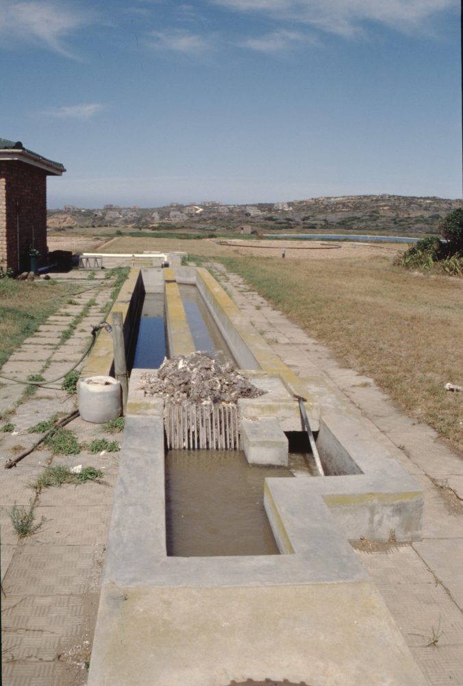
Photographs of the Western Cape province of South Africa from around 2000 through 2002. The gallery covers housing projects, a wastewater treatment site, a dam project, natural landscapes around the Kagga Kamma Nature Reserve and Cape Point, and aerial views showing landscapes around the towns of Knsyna and Little Karoo. Views include streetscapes and building exteriors, overviews of infrastructure and natural landscapes, aerial views, and portraits of Mona Serageldin.
See also:
- Gallery M16-2: Western Cape, South Africa (1998)
- Gallery M17-1: Wupperthal, Western Cape (Circa 1998-2002)
- Gallery M17-2: Elim, Western Cape (1998-2003)
- Gallery M17-3: Genadendal, Western Cape (Circa 1998)
- Gallery M17-5: Mamre, Western Cape (Circa 2000)
Gallery M19-1. MSDA: Mona Serageldin Digital Archive. Institute for International Urban Development. I2UD Digital Library. Digitized May 2022.


GALLERY M19-2: Cape Town, Western Cape, South Africa (1998-2002)
125 images
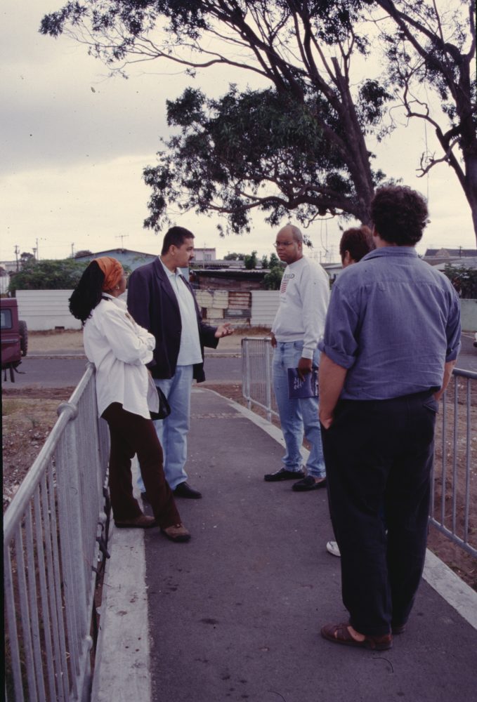
This gallery covers housing and upgrading projects in Cape Town in the Western Cape province of South Africa, from around 1998 through 2002. Photographs include views of informal settlements, new housing projects, and locations with environmental issues, including an area previously hit by a tornado. The gallery also shows Mona Serageldin at various landmarks near Cape Town, including the Cape of Good Hope.
See also:
- Gallery M16-2: Western Cape, South Africa (1998)
- Gallery M17-1: Wupperthal, Western Cape (Circa 1998-2002)
- Gallery M17-2: Elim, Western Cape (1998-2003)
- Gallery M17-3: Genadendal, Western Cape (Circa 1998)
- Gallery M17-5: Mamre, Western Cape (Circa 2000)
Gallery M19-2. MSDA: Mona Serageldin Digital Archive. Institute for International Urban Development. I2UD Digital Library. Digitized May 2022.


GALLERY M20-1: Durban, KwaZulu-Natal, South Africa (1998-2002)
69 images
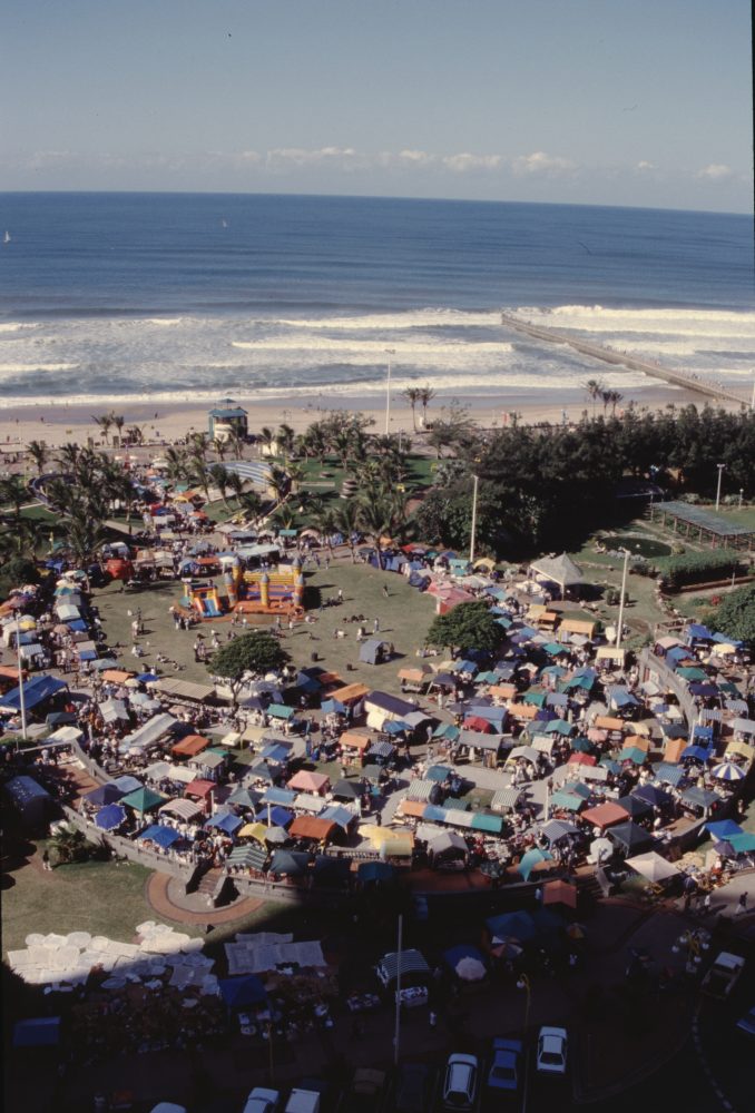
Photographs of the coastal city of Durban in the province of KwaZulu-Natal in South Africa from 1998-2000 and 2002. The gallery documents the waterfront region of the city and the metro area extension to the south, including views of old housing and new private housing developments. Images show aerial views of the region and resort beachfront, overviews of housing, roadways, and natural landscapes, and interiors of a new shopping mall.
See also:
Gallery M16-1: KwaZulu-Natal, South Africa (1998-1999)
Gallery M20-1. MSDA: Mona Serageldin Digital Archive. Institute for International Urban Development. I2UD Digital Library. Digitized October 2022.


GALLERY M20-2: Gauteng, South Africa (1996-1999)
52 images
This gallery covers the Gauteng province in northern South Africa from 1996 through 1999, including the city of Pretoria. Photographs document architecture and landscapes throughout Pretoria, waterways and ecology of a bird sanctuary, and a mine workers’ settlement on the road towards Pilanesberg. Views in Pretoria include new office buildings, the Pretoria Boys High School, the Union Buildings, and historic houses.
See also:
Gallery M16-5: Gauteng, South Africa (1998-1999)
Gallery M20-2. MSDA: Mona Serageldin Digital Archive. Institute for International Urban Development. I2UD Digital Library. Digitized December 2022.


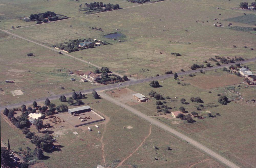
GALLERY M20-3: Bloemfontein, Free State, South Africa (2000)
15 images
Photographs of agricultural and residential regions outside of the city of Bloemfontein in Free State, South Africa from February 2000. Photographs consist of aerial views from an airplane of land divisions of farmland, housing, and roadways, as well as rivers running through the area.
Gallery M20-3. MSDA: Mona Serageldin Digital Archive. Institute for International Urban Development. I2UD Digital Library. Digitized December 2022.


GALLERY M20-4: Western Cape, South Africa (Circa 2000-2003)
55 images
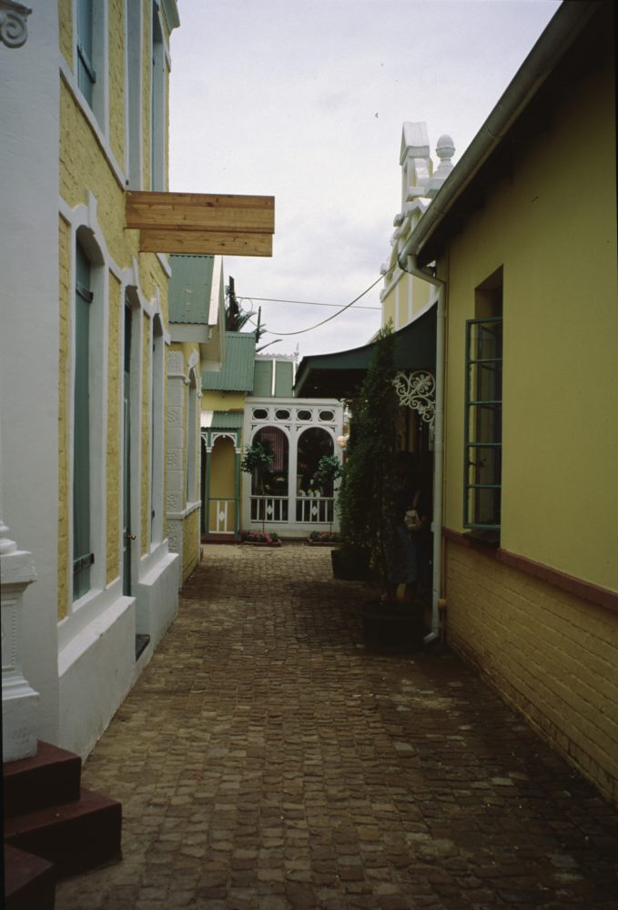
Photographs of the Western Cape province of South Africa from around 2000 through 2003. The gallery primarily covers housing projects around Stilbaai, Elim, and Cape Town, natural landsapes at Cape Agulhas and Kagga Kamma Nature Reserve, and historic housing in the town of Prince Albert. Images include views of landscape from roadways, portraits, and overviews of building exteriors, streets, and water infrastructure. Mona Serageldin is pictured.
See also:
- Gallery M16-2: Western Cape, South Africa (1998)
- Gallery M17-1: Wupperthal, Western Cape (Circa 1998-2002)
- Gallery M17-2: Elim, Western Cape (1998-2003)
- Gallery M17-3: Genadendal, Western Cape (Circa 1998)
- Gallery M17-5: Mamre, Western Cape (Circa 2000)
Gallery M20-4. MSDA: Mona Serageldin Digital Archive. Institute for International Urban Development. I2UD Digital Library. Digitized December 2022.


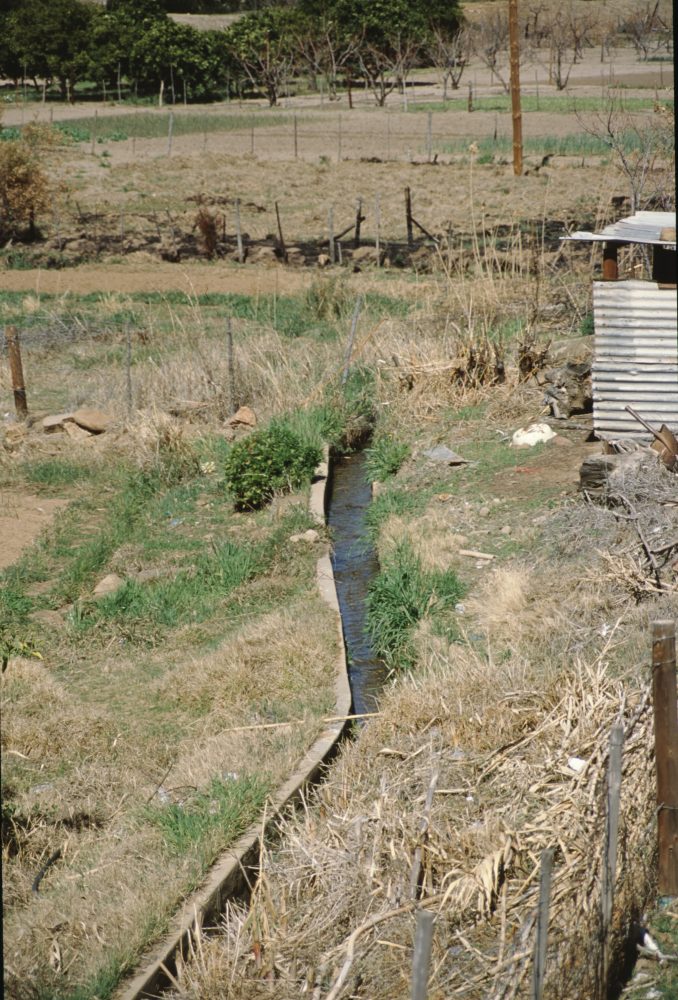
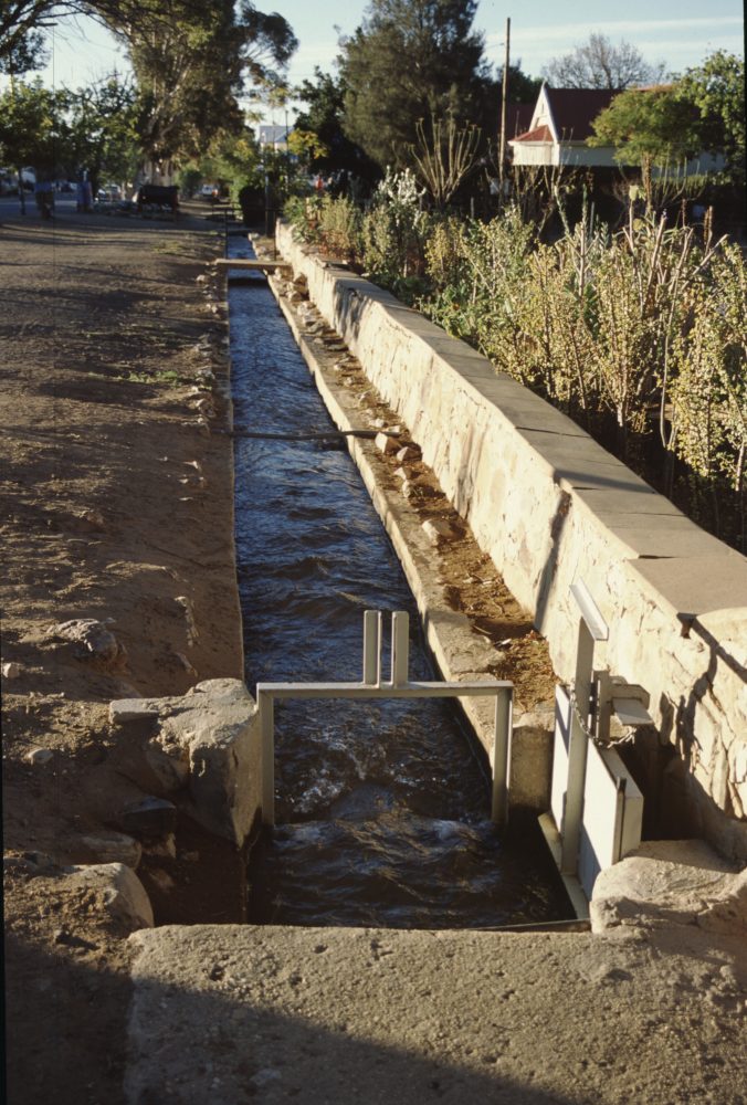
GALLERY M20-5: Wupperthal, Western Cape, South Africa (2003)
55 images
Photographs of the town of Wupperthal in the Cederberg mountains of Western Cape, South Africa from September 2003. The gallery covers natural landscapes, town housing and streetscapes, and views of river crossing with footbridge. Images also show agriculture and drainage systems in the town.
See also:
- Gallery M16-2: Western Cape, South Africa (1998)
- Gallery M17-1: Wupperthal, Western Cape (Circa 1998-2002)
- Gallery M17-2: Elim, Western Cape (1998-2003)
- Gallery M17-3: Genadendal, Western Cape (Circa 1998)
- Gallery M17-5: Mamre, Western Cape (Circa 2000)
Gallery M20-5. MSDA: Mona Serageldin Digital Archive. Institute for International Urban Development. I2UD Digital Library. Digitized December 2022.


Previous Page: Australia and the Red Sea Region (M18)
Next Page: Poland, France, and Latin America (M26)