
MSDA // Photographs / M18
Australia and the Red Sea
2000
7 galleries of digitized film slides covering Australia and the Red Sea region of Egypt
Overview
The following 7 galleries represent Mona Serageldin’s 35mm film slide collection from her travels in September 2000, as arranged in box M18: “Australia, Red Sea,” consisting of color images of those regions.
The collection documents the preservation and revitalization of historic districts and natural landscapes in Northern Territory, Australia and along the Red Sea coast of Egypt, from El Gouna to El Qoseir. The photographs support I2UD’s research in urban planning programs for historic districts, in particular for I2UD’s master plan on urban revitalization in El Qoseir from 2000. Images show urban streetscapes, new and old housing structures, and natural landscapes of rock structures and coastal environments.
Galleries 1-4 cover towns and landscapes in Northern Territory and Sydney, Australia.
Galleries 5-7 show historic urban fabric and coastal landscapes in the Red Sea region of Egypt.
Galleries
Gallery M18-1: Hermannsburg, Australia (2000)
Gallery M18-2: Kata Tjuta, Australia (2000)
Gallery M18-3: Uluru, Australia (2000)
Gallery M18-4: Sydney, Australia (2000)
Gallery M18-5: Red Sea Report Selection (Circa 2000)
Gallery M18-6: Red Sea, Quseer, Egypt (Circa 2000)
Gallery M18-7: Red Sea Presentation Selection (2000)
Related Materials
For more context and access to project reports from I2UD’s work in Egypt and Australia, as well as historic districts in various locations, see relevant projects in the I2UD Digital Library:
- “Master Plan for the Revitalization of the Older Urban Fabric,” Preservation in the Old City of Al Qusair, Egypt (Project ID: 2000_00_002)
- Design Studio 1984: “The Revitalization of a Traditional Urban Quarter,” Medieval Darb al Ahmar District, Cairo, Egypt (Project ID: 1984_01_001)
- “Preserving the Historic Urban Fabric in a Context of Fast-Paced Change,” Research Essay, Mona Serageldin (Project ID: 1998_11_001)
- “Climate Change in the Local Development Agenda,” I2UD Report on Alexandria, Egypt and Cotonou, Benin, for the 5th World Bank Urban Research Symposium (Project ID: 2009_00_002)
- “Best Practices and Local Leadership Programme,” Review of International Urban Development Projects for UN-Habitat (Project ID: 1995_00_007)
Related image collections:
- MSDA Photograph Collection M02: Medieval Cairo (1978-1996)
- MSDA Photograph Collection M05: Historic Districts (1987-1998)
- I2UD Photograph Collection, Galleries 6-7: Cairo and Informal Settlements, Egypt (1986, 1990-1993)
Previous Page: South Africa (M17)
Next Page: South Africa tours (M19-M20)

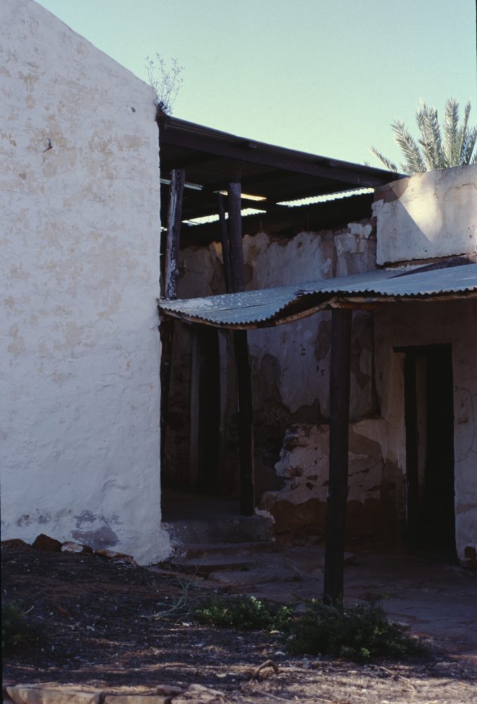
GALLERY M18-1: Hermannsburg, Australia (2000)
145 images
This gallery contains photographs of the town of Ntaria, also known as Hermannsburg, in Northern Territory, Australia from September 2000. Also shown are the nearby town of Alice Springs (Mparntwe), Palm Valley (Mpulungkinya) along the Finke River, and views along the road between the Uluṟu-Kata Tjuṯa National Park and Ntaria. Images cover exterior and interior views of historic Lutheran mission buildings, overviews of housing and town streetscapes, and views of rock structures and foliage in area landscapes.
Gallery M18-1. MSDA: Mona Serageldin Digital Archive. Institute for International Urban Development. I2UD Digital Library. Digitized February 2022.


GALLERY M18-2: Kata Tjuta, Australia (2000)
30 images
Photographs of the Kata Tjuta mountain region, also known as the Olgas, in Northern Territory, Australia from September 2000. Images show views along walking tour in the Uluṟu-Kata Tjuṯa National Park of mountain formations and surrounding foliage and ecosystems.
Gallery M18-2. MSDA: Mona Serageldin Digital Archive. Institute for International Urban Development. I2UD Digital Library. Digitized February 2022.


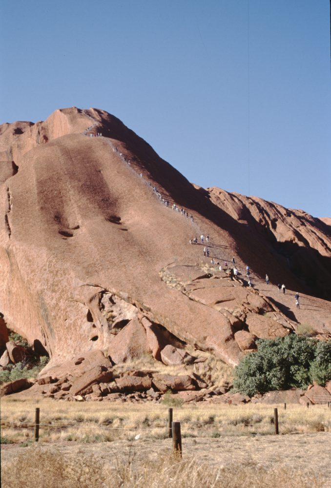
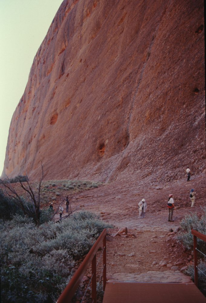
GALLERY M18-3: Uluru, Australia (2000)
68 images
Photographs of Uluru, also known as Ayers Rock, a sandstone monolith in Northern Territory, Australia from September 2000. Views from the gallery include landscape and detail views of rock formations, the Finke River, and surrounding ecosystems. Mona Serageldin is pictured near the end of the gallery.
Gallery M18-3. MSDA: Mona Serageldin Digital Archive. Institute for International Urban Development. I2UD Digital Library. Digitized February 2022.


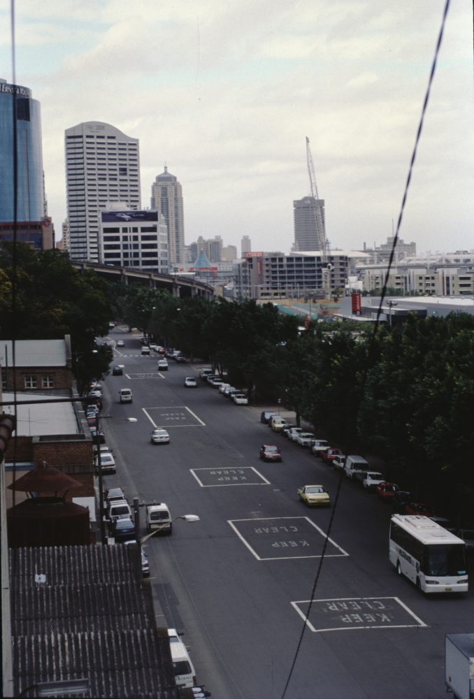
GALLERY M18-4: Sydney, Australia (2000)
70 images
Photographs of historic neighborhood of the Rocks in Sydney, New South Wales, Australia from September 2000. Images show historic architecture and housing exteriors, a new high-rise residential building, and neighborhood streetscapes. The gallery also includes views of historic landmarks like the Sydney Opera House and Sydney Harbour Bridge, as well as views from a skyscraper looking out over city blocks and skyline.
Gallery M18-4. MSDA: Mona Serageldin Digital Archive. Institute for International Urban Development. I2UD Digital Library. Digitized February 2022.


GALLERY M18-5: Red Sea Report Selection (Circa 2000)
41 images
This gallery contains photographs of the Red Sea coast near El Gouna, Hurghada, and Quseer, Egypt from around 2000, curated for potential inclusion in I2UD’s report on historic urban fabric revitalization. Images cover general views of the Red Sea, tourist developments, upgraded informal settlements, resettlement housing, and views of a public garden and coffee shop. Views overall show landscapes, streetscapes, and building exteriors.
Gallery M18-5. MSDA: Mona Serageldin Digital Archive. Institute for International Urban Development. I2UD Digital Library. Digitized February 2022.


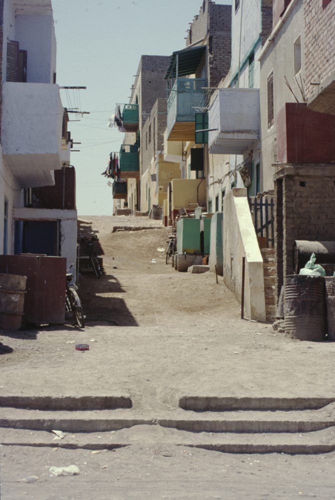
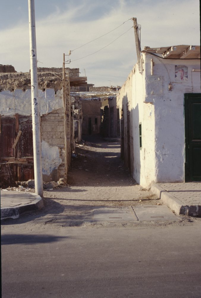
GALLERY M18-6: Red Sea, Quseer, Egypt (Circa 2000)
110 images
Photographs of Quseer, Egypt along the Red Sea coast, from around 2000. Images show views of the El Quseir Fort and surrounding area, along with views of housing developments and project sites. Views include coastline landscapes, city streetscapes, rooftops, and building exteriors. There are also two graphics showing architectural layouts and housing of the city.
Gallery M18-6. MSDA: Mona Serageldin Digital Archive. Institute for International Urban Development. I2UD Digital Library. Digitized February 2022.


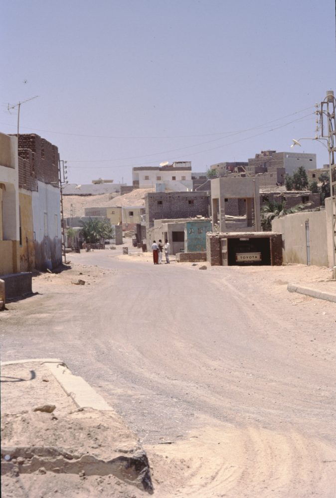
GALLERY M18-7: Red Sea Presentation Selection (2000)
45 images
Photographs of Quseer, Egypt along the Red Sea coast from September 2000, originally curated for a presentation. Images show the Red Sea coastline and surrounding landscapes, housing developments, and views from main roads.
Gallery M18-7. MSDA: Mona Serageldin Digital Archive. Institute for International Urban Development. I2UD Digital Library. Digitized February 2022.


Previous Page: South Africa (M17)
Next Page: South Africa Tours (M19-M20)