
MSDA // Photographs / M02
Medieval City of Cairo, Egypt
1978-1996
9 galleries of digitized film slides of architecture, housing, and urban social fabric in Historic Cairo, Egypt
Overview
The following galleries represent the original slide curation established by Mona Serageldin, corresponding to slide box M02, titled “Cairo Medieval City.”
Historic architecture and landmarks pictured include:
- Al Darrasa El-Gamaleya, El Gamaliya, Cairo Governorate, Egypt (1985)
- Sultan Hanan Mosque (1984-1986)
- Towhead Rann Mosques along the Tabbana (1988)
- Sehemi House, Moayad Mosque (1988)
- Darb El Ahmar Mosque (1984)
- Facade of the Tabbana Rap, Cairo (1982)
Locations and landmarks pictured include:
- The Aquaduct
- Eastern Walls of City
- Sultan Hasan Mosque
- Rumayla Square
- Bab Zwayla
- Oasaba Outside Bab Zwayla
- Bayn al-Qasrayn
- Braquq N. Cemetery
- Qaitbay Mosque and Cemetery
- Sayyeda Nafisa;
- S. Door of Cairo;
- The Citadel
- Sultan Hasan Mosque
- Qara Modae
- Bulah Mosque Abu al-Ela
- Al Sukariyya
- Baynal-Gasryn
- Ghouriya N. Cemetery
- Mamluk Mans. S. of Citadel
- ‘Thutnefer’s Townhouse’, Thebes
- Radwan Bey Palace
- Mosque of Ibn Tolon (Tulun)
- Sultan Hassan mosque
Galleries
Gallery M02-1: ‘Shades and Shadows, Thresholds’ (1982-1996)
Gallery M02-2: ‘Space Hierarchy,’ Streetscapes of Medieval Cairo (1982-1986)
Gallery M02-3: Housing in the Medieval City of Cairo (1981-1986)
Gallery M02-4: Abuse of Monuments (1982-1987)
Gallery M02-5: Wikala of Sultan Quaitbay and Tabbana Rab (1980-1990)
Gallery M02-6: Darb el Ahmar (1985-1988)
Gallery M02-7: Outskirts of Old City and Cairo Cemetery (1980-1990)
Gallery M02-8: Historic Cairo Illustrations and Lithograph Plates, 1820-1850 (1978-1988)
Gallery M02-9: Panorama of Old Cairo and Overlook at Al Darrasa El-Gamaleya (1980-1990)
Note on dates:
Galleries M02, 1-9 present images dating from 1980-1996, with the bulk dating between 1980 and 1988. Additionally, galleries depict historic illustrations dated 1820-1850, and photography of Medieval Cairo from the mid-20th century.
Related Materials
Image collections on historic districts:
- MSDA Photograph Collection M05: Historic Districts (1984-1998)
- MSDA Photograph Collection M06: Fes Medina and Tunis Hafsia (1973-1999)
- MSDA Photograph Collection M11: Poland (1995-1997)
- MSDA Photograph Collection M18: Australia and the Red Sea Region (2000)
- MSDA Photograph Collection M26: Poland, France, and Latin America (1987-2004)
- MSDA Photograph Collection M41: China (1981)
Image collections on Egypt:
- MSDA Photograph Collection M01: Informal Housing in Helwan, Egypt (1970-1985)
- I2UD Photograph Collection, Gallery 6: Cairo (1990-1993)
- I2UD Photograph Collection, Gallery 7: Ghoneim Settlement, Helwan (1986)

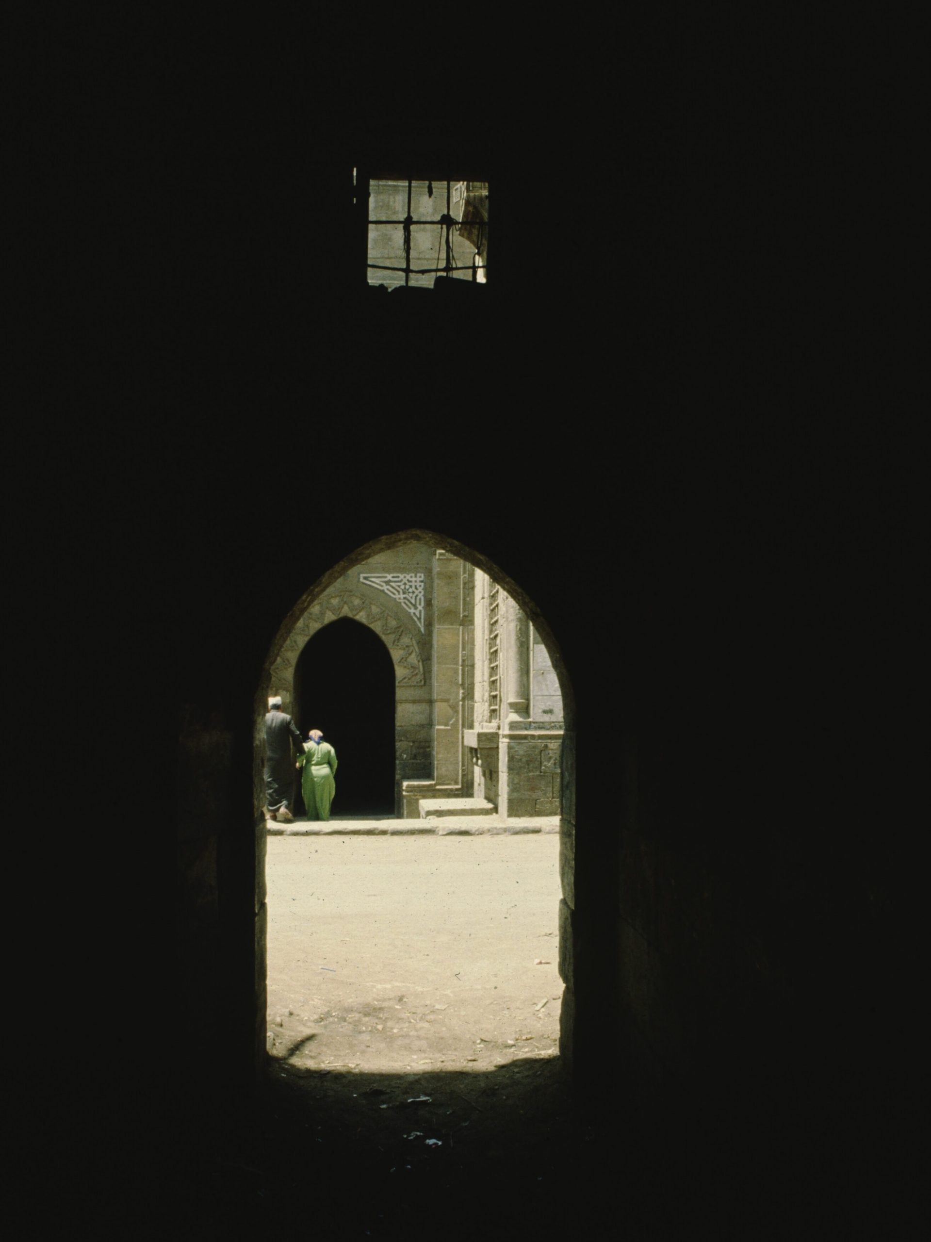
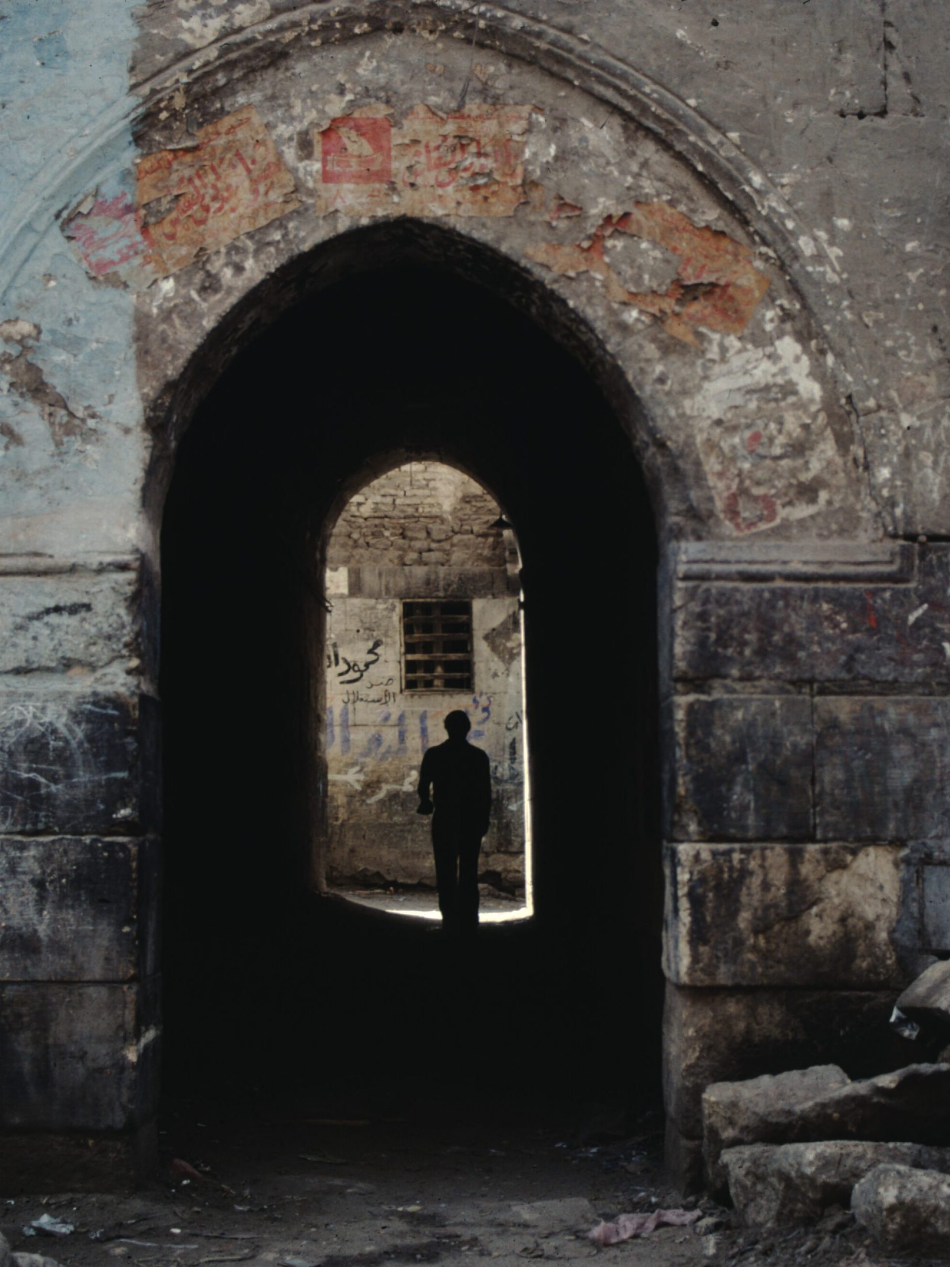
GALLERY M02-1: ‘Shades and Shadows, Thresholds’ (1982-1996)
18 images
Digitized slide photographs depicting streetscapes and historic architecture in the Medieval City, Cairo, Egypt.
This gallery is a short introduction to Serageldin’s series of images on Medieval Cairo, establishing common themes elaborated in subsequent galleries: streetscapes, panoramas, documentation of historic buildings, informal housing and squatter quarters, candid portraits of residents and passersby.
Images include panoramas showing informal shelters on roofs, details of deteriorated buildings, smokestacks, and a sky-line of mosque domes and minarets. Features historic architecture as backdrop to a bustling streetscape along covered alleys filled with pedestrians, a spice market stall, archways juxtaposed with their own shadows, and anonymous children posing on crumbling foundations.
Gallery M02-1. MSDA: Mona Serageldin Digital Archive. Institute for International Urban Development. I2UD Digital Library. Digitized June 2021.


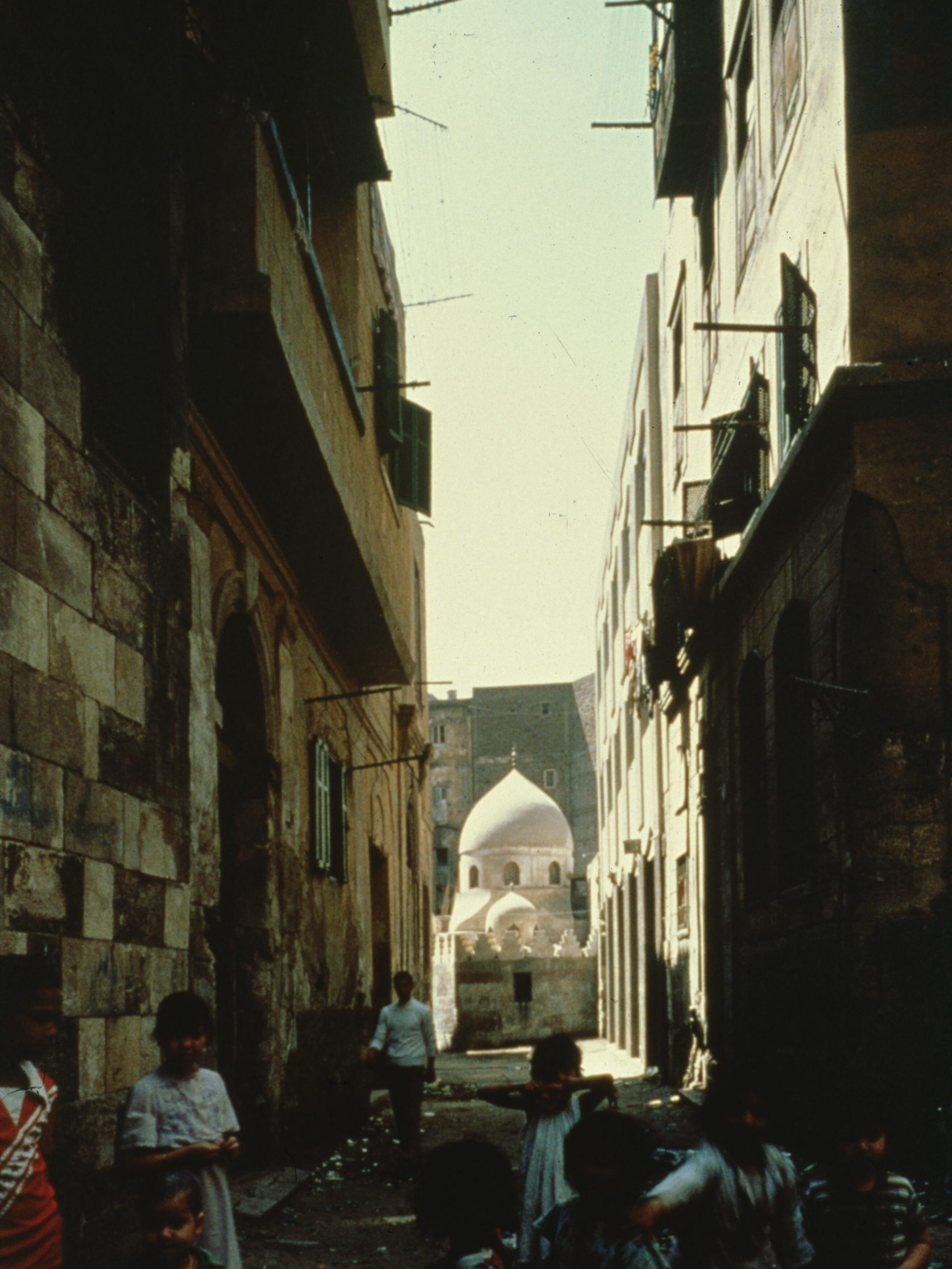
GALLERY M02-2: ‘Space Hierarchy,’ Streetscapes of Medieval Cairo (1982-1986)
78 images
Digitized slide photographs depicting streetscapes and historic architecture in the Medieval City, Cairo, Egypt. This gallery is a short introduction to Serageldin’s series of images on Medieval Cairo, establishing common themes elaborated in subsequent galleries: streetscapes, panoramas, documentation of historic buildings, informal housing and squatter quarters, candid portraits of residents and passersby.
Images include panoramas showing informal shelters on roofs, details of deteriorated buildings, smokestacks, and a sky-line of mosque domes and minarets. Features historic architecture as backdrop to a bustling streetscape along covered alleys filled with pedestrians, a spice market stall, archways juxtaposed with their own shadows, and anonymous children posing on crumbling foundations.
Gallery M02-2. MSDA: Mona Serageldin Digital Archive. Institute for International Urban Development. I2UD Digital Library. Digitized June 2021.


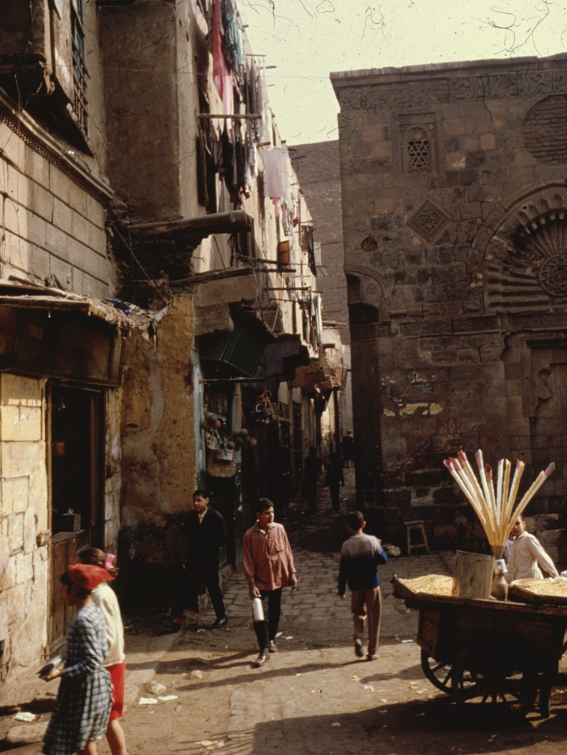
GALLERY M02-3: Housing in the Medieval City of Cairo (1981-1986)
190 images
Series: ‘Houses Medieval City: Rab and Wakala’
Slides documenting the inside of a private home in the Medieval city in Cairo. Views of living room, bedrooms and kitchen, including resident family and children.
Note: Original slide frames have handwritten marginalia in Arabic. Includes views of Housing exteriors in the Medieval City of Cairo, near Tabbana Rab, c.a. 1986, including roof-top view of existing housing in the Medieval City, as compared to housing plans for Tabbana Rab sector. Includes diagram showing “Existing Construction” with social hierarchy breakdown for existing housing, dated 1986. Note: Rooftop 4th floor designated for “squatters” and livestock, 3rd floor for “shacks”, 2nd floor for “apartments”, 1st floor for “shops”.
Series: Home interior in Medieval City, Cairo
Slides documenting the inside of a private home in the Medieval city in Cairo. Views of living room, bedrooms and kitchen, including resident family and children. Note: Original slide frame have handwritten marginalia in Arabic.
Series: Deteriorated houses
Images of deteriorated houses, outside facades, inside and detail shots of architectural damage. Includes images of historic architecture for comparison.
Series: Overview
A concluding overview of housing in the Medieval City, including diagram of “Thutnefer’s Townhouse, Thebes, 15th cen. BC” and showing the scope of urban housing in Cairo. Series includes illustrations and engravings of Medieval Cairo’s architectural landscape, in black/white and color, dated approx. 19th century. A final set of images presents an illustrated tour of architecture in the Medieval City, showing the following site and landmarks:
- The Aqueduct
- Eastern Walls of City
- Sultan Hasan Mosque
- Rumayla Square
- Bab Zwayla
- Oasaba Outside Bab Zwayla
- Bayn al-Qasrayn
- Braquq N. Cemetery
- Qaitbay Mosque and Cemetery
- Sayyeda Nafisa
- S. Door of Cairo
- The Citadel
- Sultan Hasan Mosque
- Qara Modae
- Bulah Mosque Abu al-Ela
- Al Sukariyya
- Baynal-Gasryn
- Ghouriya
- N. Cemetery
- Mamluk Mans. S. of Citadel
Gallery M02-3. MSDA: Mona Serageldin Digital Archive. Institute for International Urban Development. I2UD Digital Library. Digitized June 2021


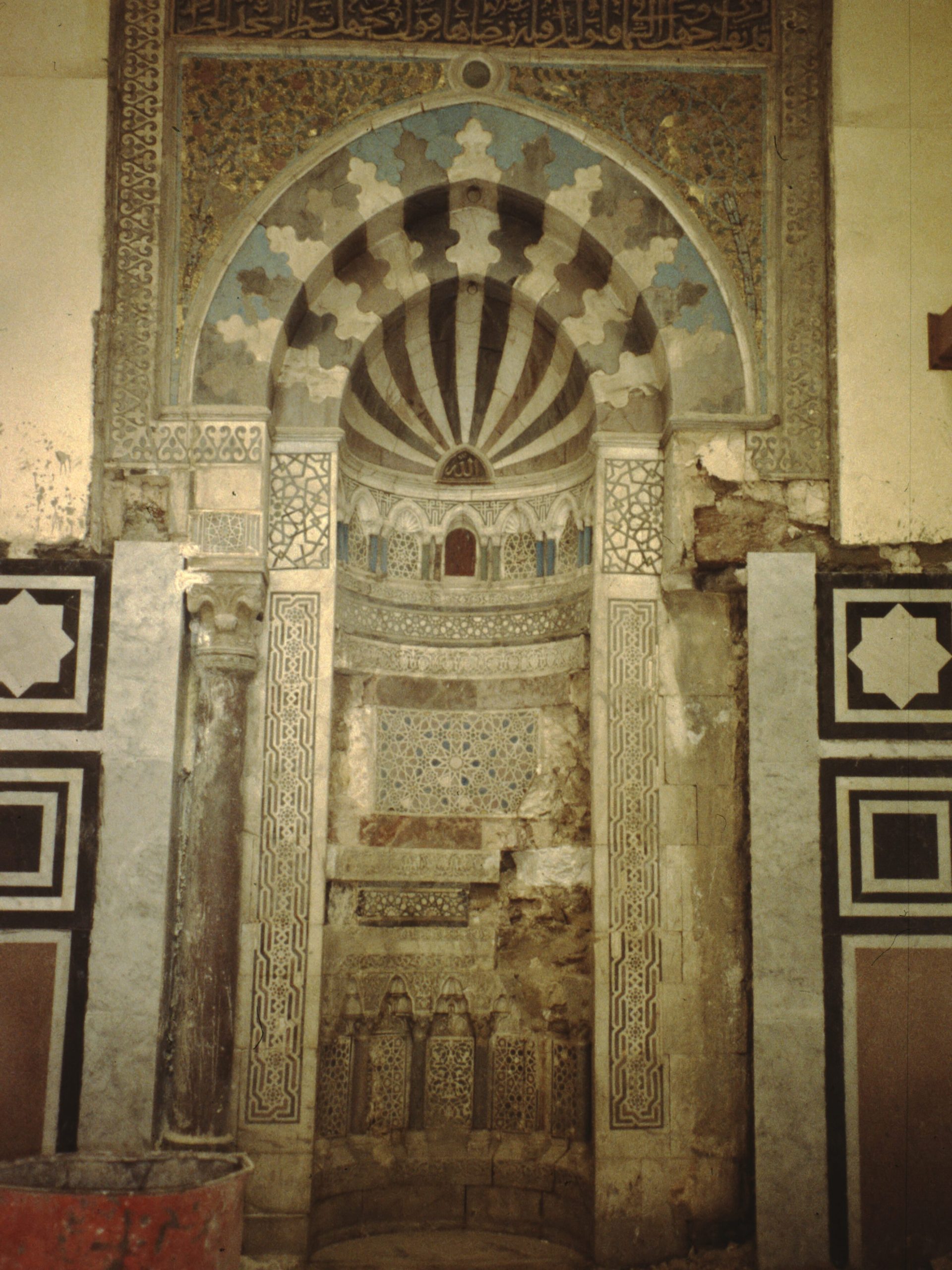
GALLERY M02-4: Abuse of Monuments (1982-1987)
41 images
Digitized slide photography depicting disintegration and condition of medieval architectural monuments in the Medieval City in Cairo, Egypt.
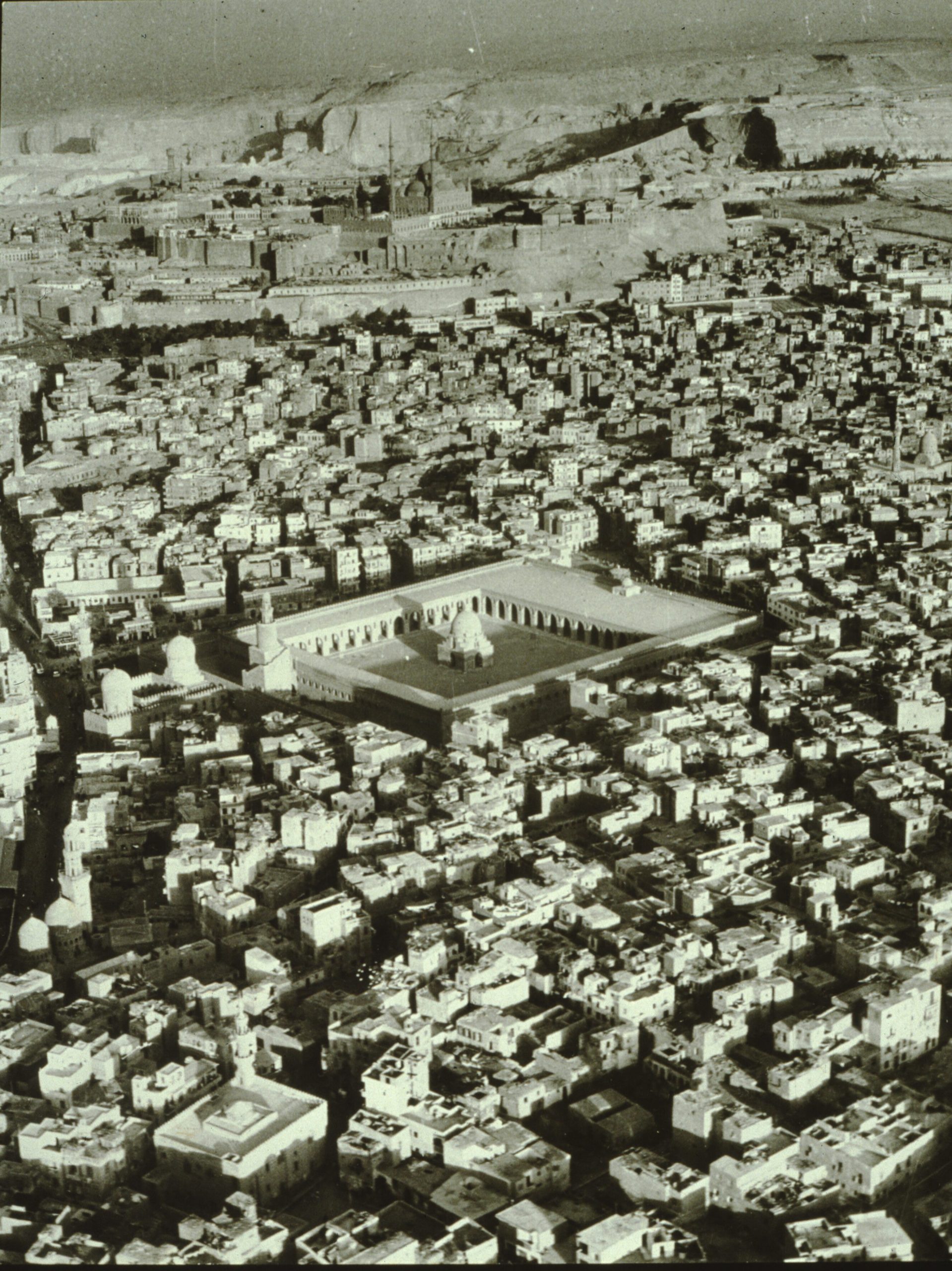
Images include detail of German restoration project in Cairo Medieval City, from 1987. Additional black and white aerial photography presents a panorama of the Medieval City of Cairo, Egypt, taken by Mohamed Youssef, approx. 1980s.
Monuments depicted include the Mosque of Ibn Tolon (Tulun), the largest, oldest mosque in Cairo surviving in its original form, and the Citadel (“the Citadel and Mohamed Aly Mosque”) in Cairo, Egypt, from September 1987.
Gallery M02-4. MSDA: Mona Serageldin Digital Archive. Institute for International Urban Development. I2UD Digital Library. Digitized June 2021


GALLERY M02-5: Wikala of Sultan Quaitbay and Tabbana Rab (1982-1988)
167 images
Digitized slide photographs from April 1982, January 1988, and December 1988, of the Wikala of Sultan Quaitbay and Rab’ al-Tabbana (Tabbana Rab),Towhead Rann Mosques, and Sultan Hassan mosque regions in the Medieval City of Cairo, Egypt.
Images show views of facade of Tabbana Rab, exterior walls and window detail, and surrounding streetscapes. Note: The Tabbana Rab is a traditional residential building constructed in 1522 by the Khayer Bek complex in the Medieval City in Cairo, Egypt.
Images include plans of The Citadel of Qaitbay and graphics of “Madrasa-mausoleum of (Umm) as-Sultan Sha’ban, A. H. 770/A. D. 1368-69,” including exterior and interior views of the Citadel of Qaitbay.
Images of Wikala architecture, and Sabil Kuttab Nefisa Al Bida, from April 1982.
Images titled “Elevated sequence” from April 1982 to December 1988, showing aerial panorama over the Medieval City of Cairo, as well as street-level views of highway overpass infrastructure intersecting old street patterns, and pedestrians.
Images of “Rab and Wakala plans” from January 1988 showing roof top views, building facades, and building plans for the Tabbana Rab and Wakala of Qaytbay area.
Images of “Towhead Rann Mosques along the Tabbana” from January 1988 showing facade, courtyard detail, gardens and wall detail of the Towhead Rann Mosques.
Images of Sultan Hassan mosque from 1988, showing exterior detail. Note: The Mosque-Madrasa of Sultan Hassan is a monumental mosque and madrasa located in the historic district of Cairo, Egypt. It was built between 1356 and 1363 during the Bahri Mamluk period, commissioned by Sultan an-Nasir Hasan.
Gallery M02-5. MSDA: Mona Serageldin Digital Archive. Institute for International Urban Development. I2UD Digital Library. Digitized June 2021


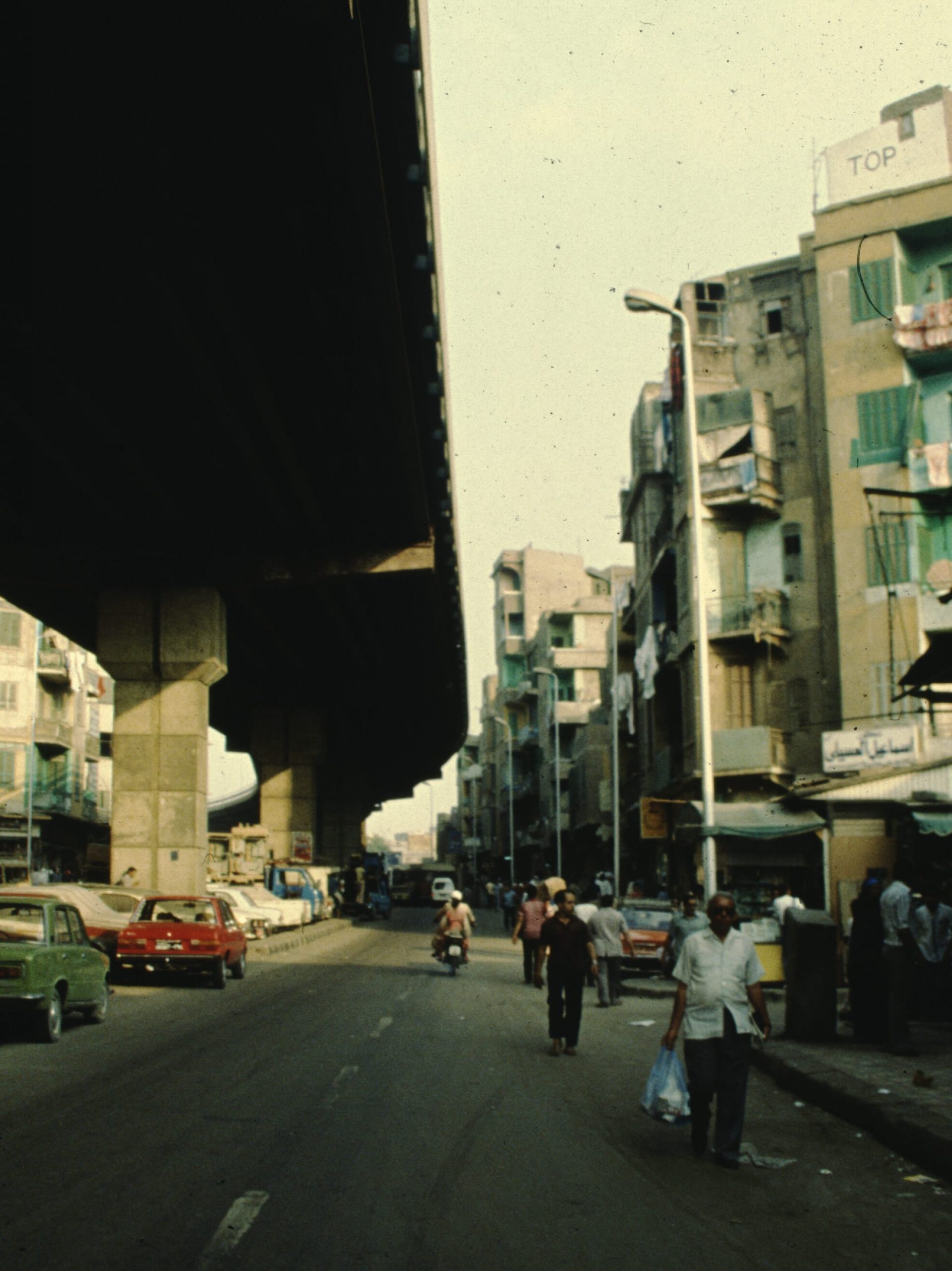
GALLERY M02-6: Darb El Ahmar (1985-1988)
58 images
Digitized slide photographs of elevated highway overpass, traffic, streetscapes, historic architecture, pedestrians and construction near Darb El Ahmar in Cairo, Egypt, from December 1984 and January 1988. Note: Al-Darb al-Ahmar (“Red Street”) is a historic neighborhood in Cairo, Egypt.
Images of streetscapes in Darb El Ahmar region, showing highway overpass infrastructure over lower roads and pedestrian ways. Images showing grounds of community center in Darb El Ahmar from January 1988, with children and residents enjoying community courtyard space. Includes graphic maps, an overview panorama and detail of historic architecture in Darb El Ahmar, from December 1984.
Gallery M02-6. MSDA: Mona Serageldin Digital Archive. Institute for International Urban Development. I2UD Digital Library. Digitized June 2021


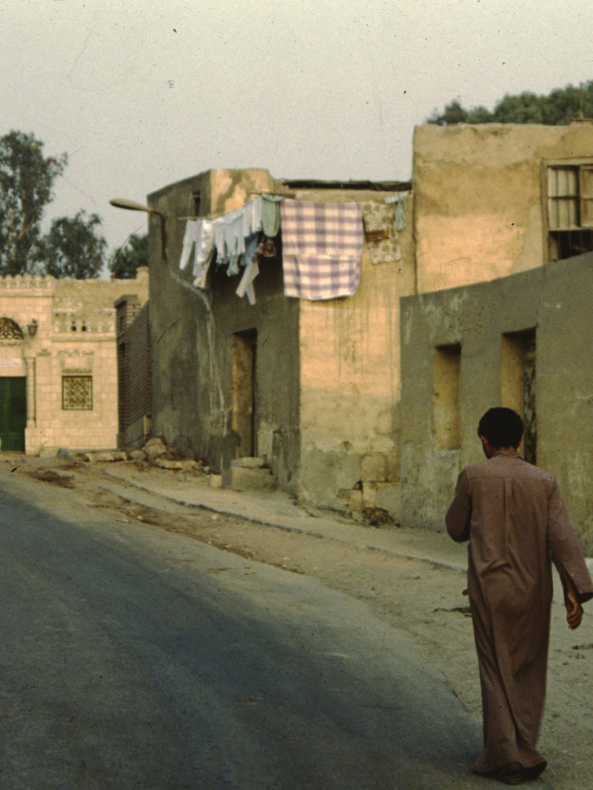
GALLERY M02-7: Outskirts of Old City and Cairo Cemetery (1981-1985)
88 images
Digitized slide photographs depicting series titled “Outskirts of Old City,” showing city infrastructure and housing typology on the perimeter of Medieval City, Cairo, 1981-1985.
Photographs dated from November 1981, April 1982, November 1984, and November 1985 showing new high-rise residential buildings, older two-three level housing, streetscapes, road intersections, pedestrians and automobile traffic.
Photographs dated from April 1982 showing views of cemetery in the Medieval City. Images of cemetery structures, surrounding streets, pedestrians and surrounding buildings, including mosques and historic architecture.
Photographs dated from September 1985 showing city infrastructure in the outskirts of the Medieval City, as well as streetscapes, open spaces, mosques, traffic, residents with vehicles, garbage dumps, and deteriorated building detail.
See also:
Gallery M05-5: Al-Azhar, Cairo, Egypt (1998)
Gallery M02-7. MSDA: Mona Serageldin Digital Archive. Institute for International Urban Development. I2UD Digital Library. Digitized June 2021


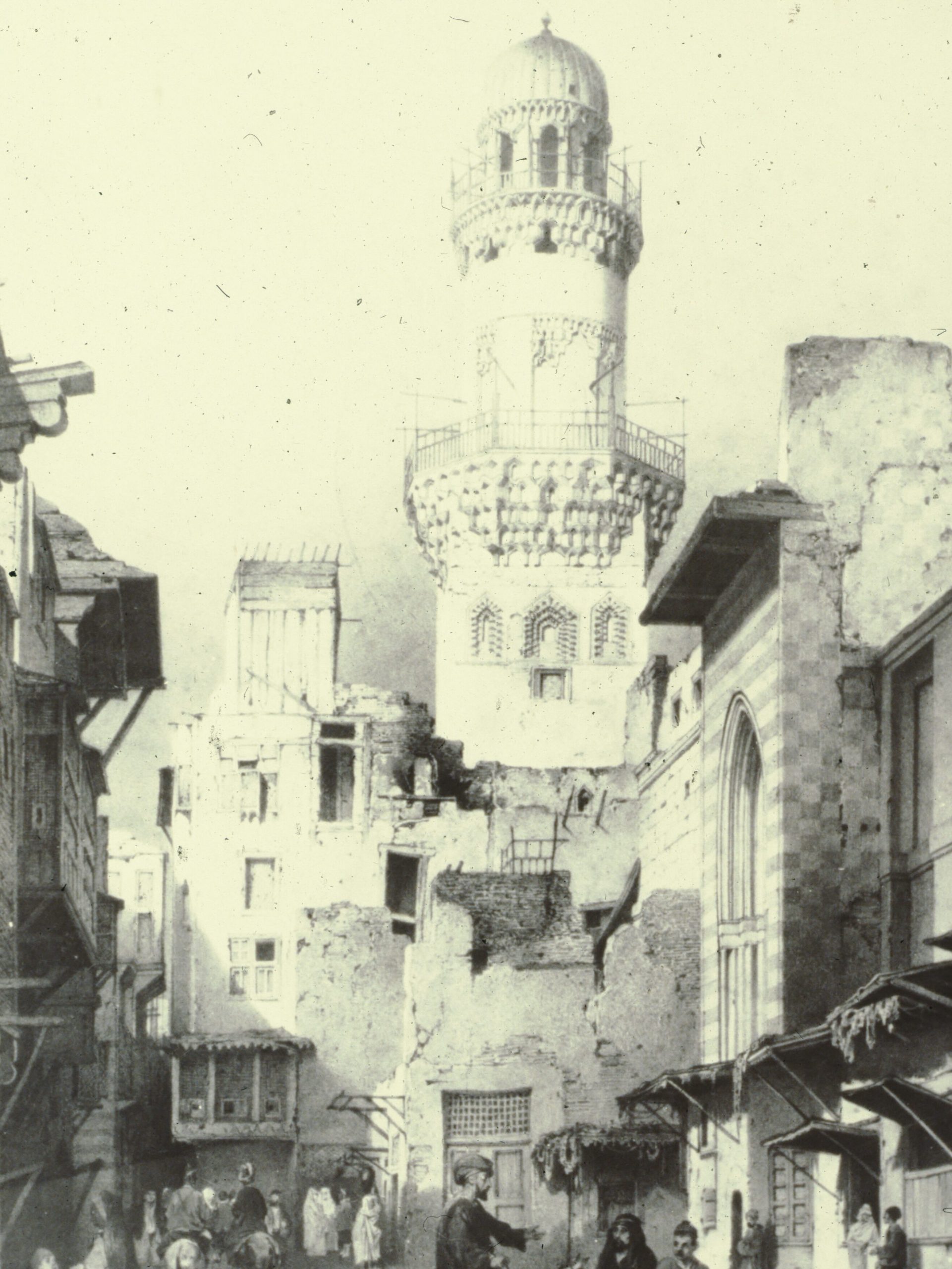
GALLERY M02-8: Historic Cairo Illustrations and Lithograph Plates, 1820-1850 (1978-1988)
156 images
Digitized slide photographs depicting series titled “Outskirts of Old City,” showing city infrastructure and housing typology on the perimeter of Medieval City, Cairo, 1981-1985.
Photographs dated from November 1981, April 1982, November 1984, and November 1985 showing new high-rise residential buildings, older two-three level housing, streetscapes, road intersections, pedestrians and automobile traffic.
Photographs dated from April 1982 showing views of cemetery in the Medieval City. Images of cemetery structures, surrounding streets, pedestrians and surrounding buildings, including mosques and historic architecture.
Photographs dated from September 1985 showing city infrastructure in the outskirts of the Medieval City, as well as streetscapes, open spaces, mosques, traffic, residents with vehicles, garbage dumps, and deteriorated building detail.
Gallery M02-8. MSDA: Mona Serageldin Digital Archive. Institute for International Urban Development. I2UD Digital Library. Digitized June 2021.


GALLERY M02-9: Panorama of Old Cairo and Overlook at Al Darrasa El-Gamaleya (1980-1990)
69 images
Digitized slide photographs depicting overlook view of Old Cairo from Al Darrasa El-Gamaleya in El Gamaliya, Cairo Governorate, Egypt. Images showing overlook of Cairo rooftops, street scenes and residential building exteriors. Images include undated aerial panorama of Cairo in black and white, and aerial views of old Cairo in color, credited to Sameh Wahba.
Images from May 1996 show streetscapes and housing overview, and images from September 1985 show view from outlook at Al Darrasa El-Gamaleya.
Gallery M02-9. MSDA: Mona Serageldin Digital Archive. Institute for International Urban Development. I2UD Digital Library. Digitized June 2021.


