
MSDA // Photographs / M01
Informal Housing in Helwan, Cairo, Egypt
1970-1985
10 galleries of digitized film slides covering informal settlements and plans of the Greater Cairo Region
Overview
The following 10 galleries represent Mona Serageldin’s analog slide collection on informal settlements in Cairo’s urban fringe, as arranged in box M01, “Cairo – Fringe – Informal Housing.”
Serageldin used original photography, projected from 35mm slides, to illustrate her lectures on the urban fringe of Cairo. Photographs illustrate housing conditions and the scope of public and private building projects in Helwan, through graphics, maps and photographs of residential settlements.
Galleries 1, 4, and 5 include Teaching and Educational materials curated by Serageldin for lectures on housing and Cairo’s urban fringe settlements, with content ranging from 1968 to 2000, including a set of aerial panorama photography by Mohamed Youssef.
Galleries 2, 3, 6, 7, 8, 9, and 10 offer a photographic tour of the informal settlements of Ghoneim and Ghoneim North Coop in the Helwan region, as well as urban fringe settlements in Abu Dahroug, El Hekr, Imbaba Moumira, Saft El Laban, and El Warraq regions, between 1980 and 1985.
Related Materials
Related image collections:
- MSDA Photograph Collection M02: Medieval Cairo (1978-1996)
- MSDA Photograph Collection M07: Informal Housing (1982-1988)
- I2UD Photograph Collection, Gallery 6: Cairo (1990-1993)
- I2UD Photograph Collection, Gallery 7: Ghoneim Settlement, Helwan (1986)
- I2UD Digital Library Study Guides, Informal Settlements Album
Galleries
Gallery M01-1: Cairo Fringe and Information Housing – Maps and Educational Materials (1970-1990)
Gallery M01-2: Nazlet El-Semman and Al Massar, Egypt (1980-1985)
Gallery M01-3: Old and New Informal Settlements, Ghoneim, Helwan (1980-1982, 1985)
Gallery M01-4: Aerial Views of New Towns, Cairo (Circa 1980s)
Gallery M01-5: Teaching Materials on Cairo’s Urban Fringe and Informal Housing Settlements (1982-2000)
Gallery M01-6: Public Housing Selection: Helwan Public Housing and Imbaba Squatter Settlements, Helwan (1982-1985)
Gallery M01-7: Ghoneim Main Settlement and Ghoneim North Coop, Helwan (September 1985)
Gallery M01-8: Ghoneim North Coop Housing and Informal Settlements in Southern Fringe, Helwan Area (1980-1985)
Gallery M01-9: Informal Settlements in Abu Dahroug, El Hekr, and Imbaba Moumira, Cairo (1981-1984)
Gallery M01-10: Scenes in Saft El Laban and El Warraq, Giza (1984-1985)
Next Page: Medieval Cairo (M02)

GALLERY M01-1: Cairo Fringe and Informal Housing: Maps and Educational Materials (1970-1990)
160 images
Slides of diagrams and statistical charts comparing Cairo fringe urban development, housing settlement and construction, to neighboring nations, 1970-1990.
Technical analysis and presentation of urban development projects and population statistics, including maps of major Egyptian urban housing settlements, construction plans, and quantitative analysis of Cairo’s migrant experience, 1970-1990.
Diagrams of housing statistics, noting housing layout plans, diagrams of informal housing, house and courtyard designs, architectural plans, housing transformation illustrations, maps urban development projections and diagrams of city density.
Comparative statistical models represent migrant income distribution, population growth to 1990, with a comparison to USA family income and population characteristics. Also notes international migrant worker employment statistics by gender, for “wives of migrant workers,” alongside a rural/urban breakdown of work by gender for the Cairo region.
Additional data depicts comparative statistics from 1970-1980 for the following countries and cities: Morocco, Kuwait, Saudi Arabia, Jordan, Sudan, Iraq, Yemen, France and China. Cities depicted: Cairo, and Madinet Nasr, Egypt; Cairo La Butte, France; Sanaʽa, Yemen; Takadoum, Rabat, Morocco; Doum, Central African Republic; Amman, Jordan; Casablanca, Rabat-Sale, Fes, Morocco; Shanghai, China; and Kuwait.
Statistics include charts of urban income distribution, age and gender structure, land and construction costs and income, construction labor costs, household expenses, population of nationals and non-nationals.
See also: I2UD Digital Library Study Guides, Informal Settlements Album
Gallery M01-1. MSDA: Mona Serageldin Digital Archive. Institute for International Urban Development. I2UD Digital Library. Digitized June 2021.


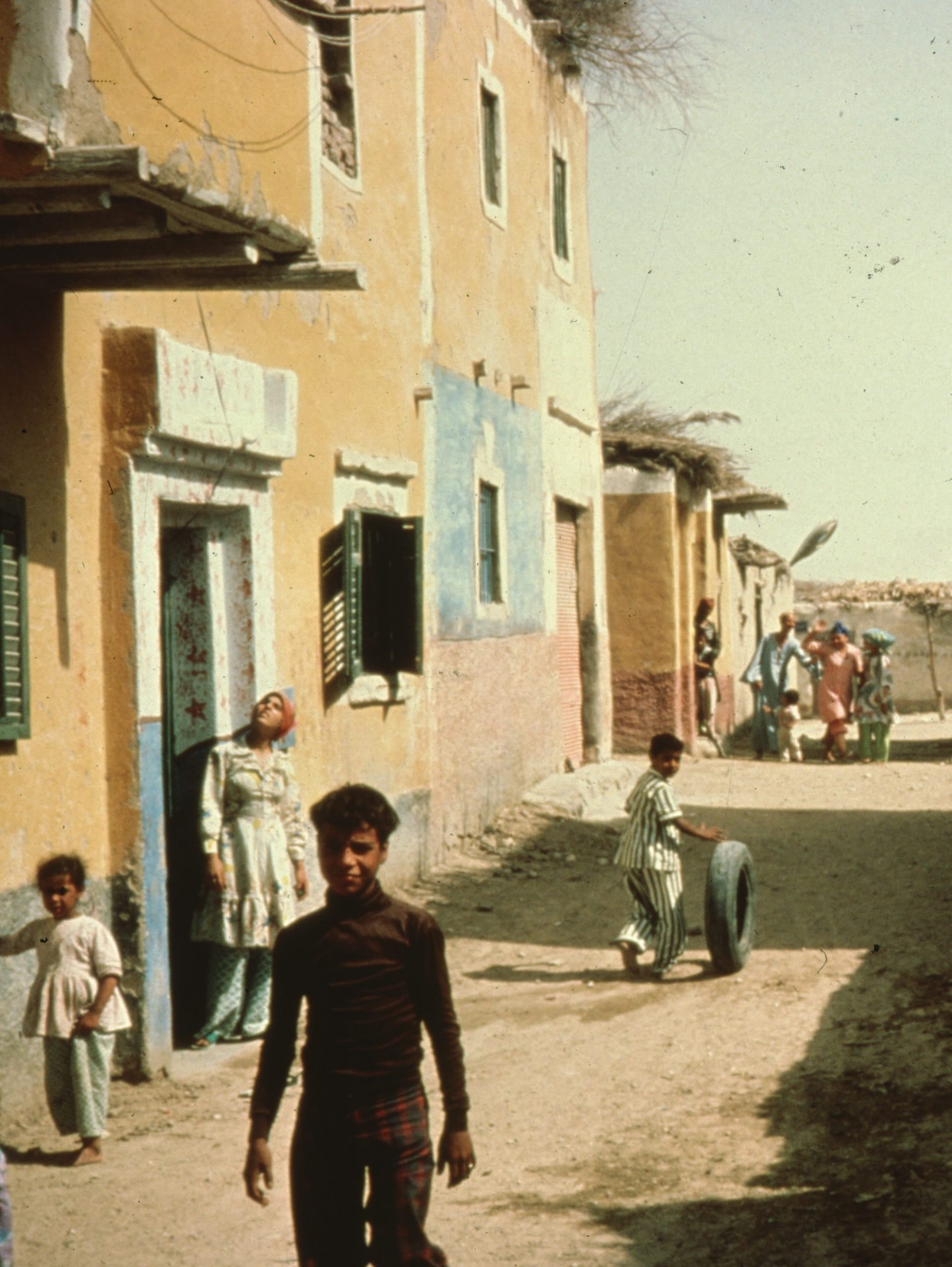
GALLERY M01-2: Nazlet El-Semman and Al Massara, Egypt (1980-1985)
13 images
Digitized slides depicting photographs of informal settlements and urban fringe housing in Nazlet El-Semman and Al Massara, outside Cairo, Egypt, 1980-1985. Includes images documenting informal squatter housing in and population of Al Massara, originally captioned ‘Zabbelin’ or zabbaleen, meaning ‘trash people’.
Gallery M01-2. MSDA: Mona Serageldin Digital Archive. Institute for International Urban Development. I2UD Digital Library. Digitized June 2021.


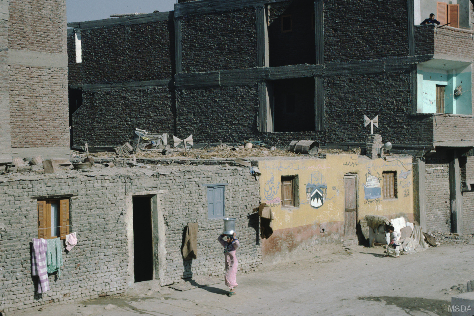
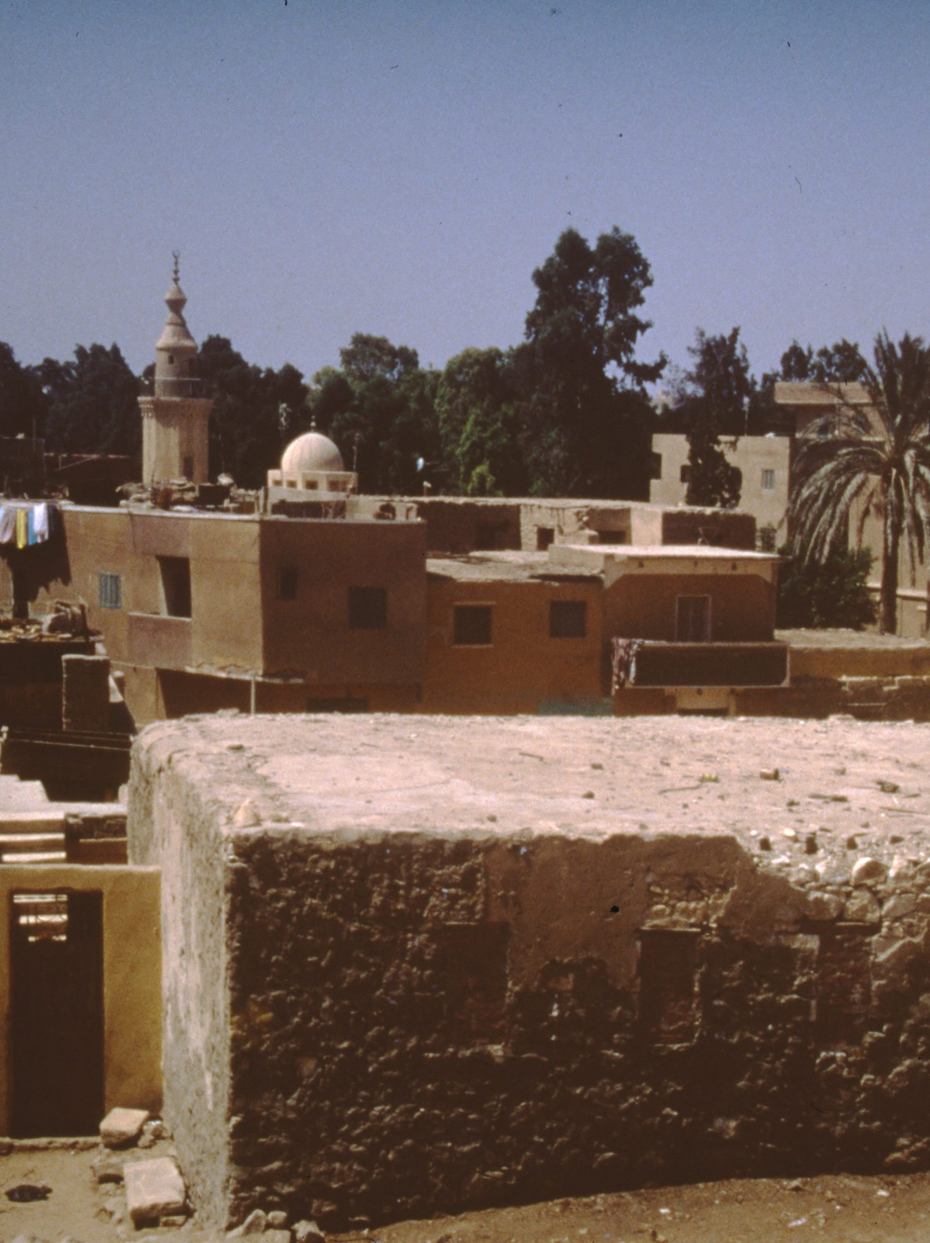
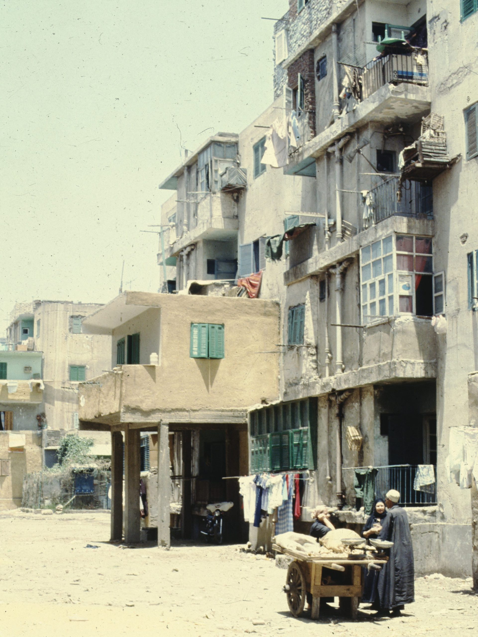
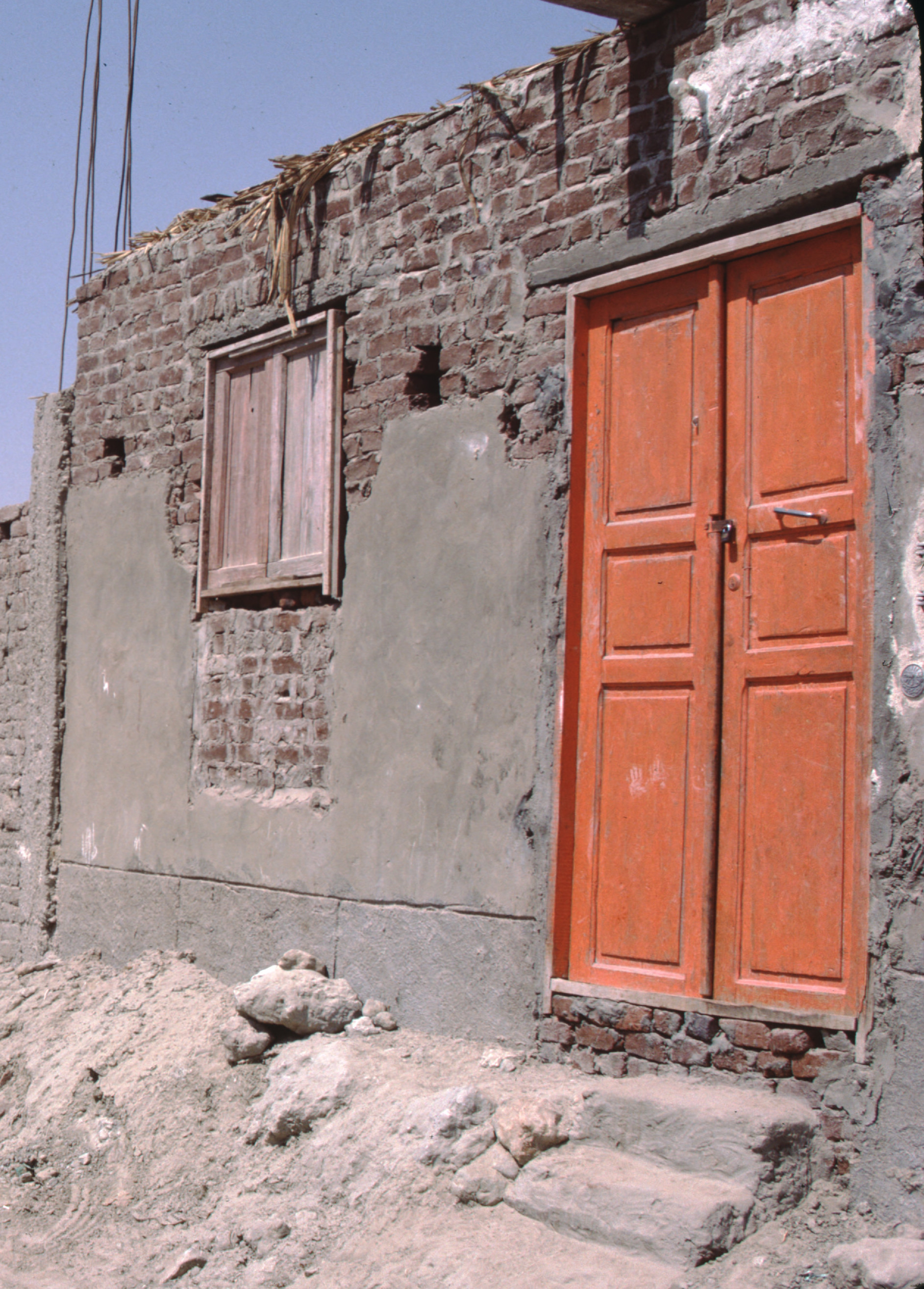
GALLERY M01-3: Old and New Informal Settlements, Ghoneim, Helwan (1980-1985)
50 images
Slides of photographs of Ghoneim informal settlement in Helwan, Egypt, 1980-1982, and 1985.
Digitized slides depict photographs of streetscapes and exteriors of old and new housing in the informal settlement of Ghoneim, outside Cairo, Egypt.
Image subjects include conditions in Ghoneim, showing waterfront and water access, women and children interacting with the photographer, streetscapes and internal alleyways, new housing projects, old dwellings and roof views. Some slides include original penciled titles: “Self Help,” “No Sewer,” and “Misery.”
See also:
- Gallery M01-7: “Ghoneim Main Settlement and Ghoneim North Coop in Helwan, Egypt” (September 1985)
- Gallery M01-8: “Ghoneim North Coop Housing, and Informal Settlements in Southern Fringe, Helwan Area” (1980-1985)
- I2UD Digital Library Study Guides, Informal Settlements Album
Gallery M01-3. MSDA: Mona Serageldin Digital Archive. Institute for International Urban Development. I2UD Digital Library. Digitized June 2021.


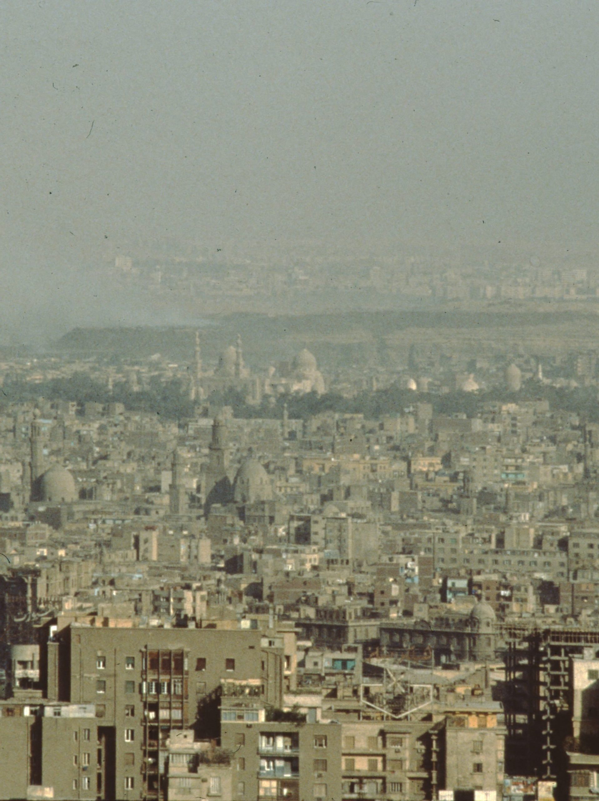
GALLERY M01-4: Aerial Views of New Towns, Cairo (Circa 1980s)
15 images
Digitized slides depicting aerial photography of Cairo, Egypt, credited to Mohamed Youssef from around the 1980s.
Slides of photographs depicting aerial overview of Cairo, Egypt, documenting urban landscape. Includes selection of graphics showing soil conditions outside Cairo, Egypt, and images of factory and river pollution.
Gallery M01-4. MSDA: Mona Serageldin Digital Archive. Institute for International Urban Development. I2UD Digital Library. Digitized June 2021.


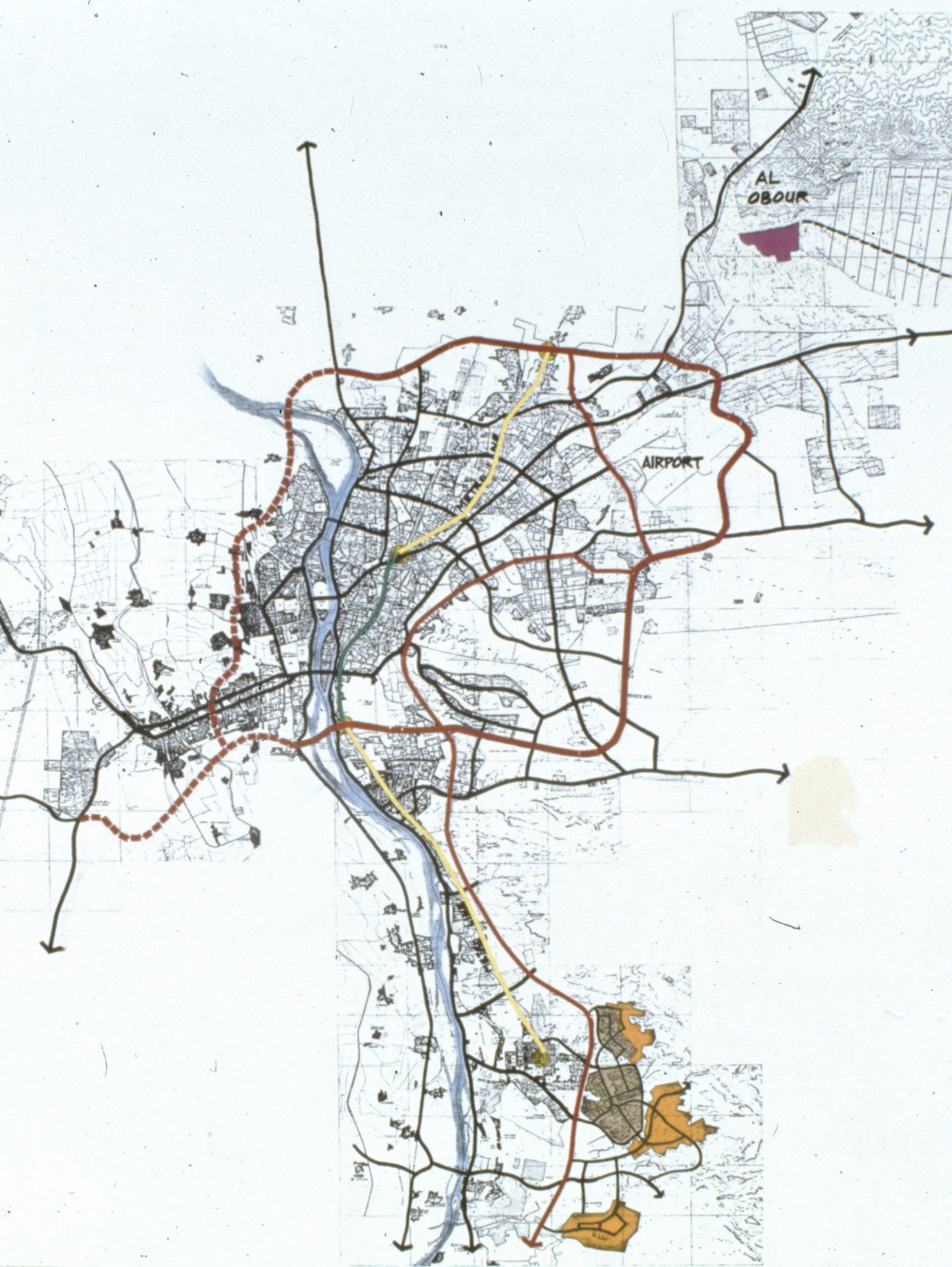
GALLERY M01-5: Teaching Materials on Cairo’s Urban Fringe and Informal Housing Settlements (1982-2000)
63 images
Digitized slides from Mona Serageldin’s selection of materials used for lectures on informal settlements and urban planning for the Cairo area, dated 1982 through 2000.
Educational materials and subjects include urban development plans, maps, and projected land use for Cairo, Egypt. Photography presents views of Cairo and Giza from a study tour in July 1983, and of Dokki and Huda Saqr from 1982.
Images show new building and housing sites, including maps of Cairo Egypt, depicting part of Nile Delta showing the growth of the Cairo metropolis. An original note included with the slides explains: “Grey dots in dark green fields represent towns and villages. The desert is peach colored (Natural color). Landsat image mosaic of all of Egypt. In this false color rendition water looks black and vegetation (Nile Valley and Delta) appear red (infra red film)”
Diagrams also show regional migration as a function of “desertification” in the Cairo region. Statistical maps display sewage and waste infrastructure in Cairo, as of 2000, compared to city infrastructure in 1940, 1968, 1977 and 1982. Statistical graphs note the impact of a “worldwide impact of labor movement’ showing household expenditures and worker movement and remittance patterns between Egypt, Saudi Arabia, and Kuwait around 1990.
Gallery M01-5. MSDA: Mona Serageldin Digital Archive. Institute for International Urban Development. I2UD Digital Library. Digitized June 2021.


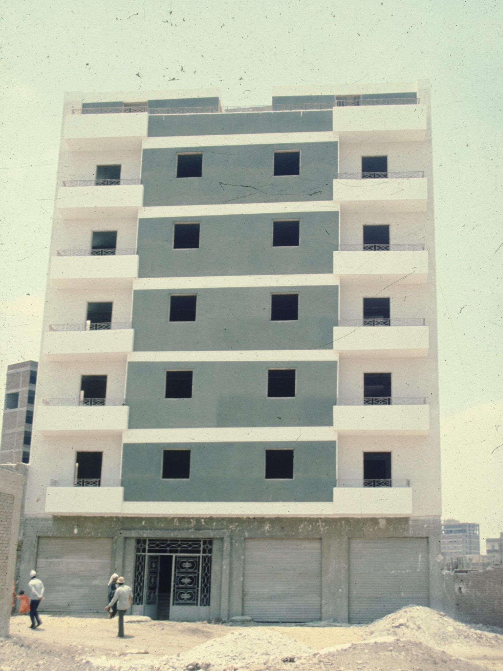
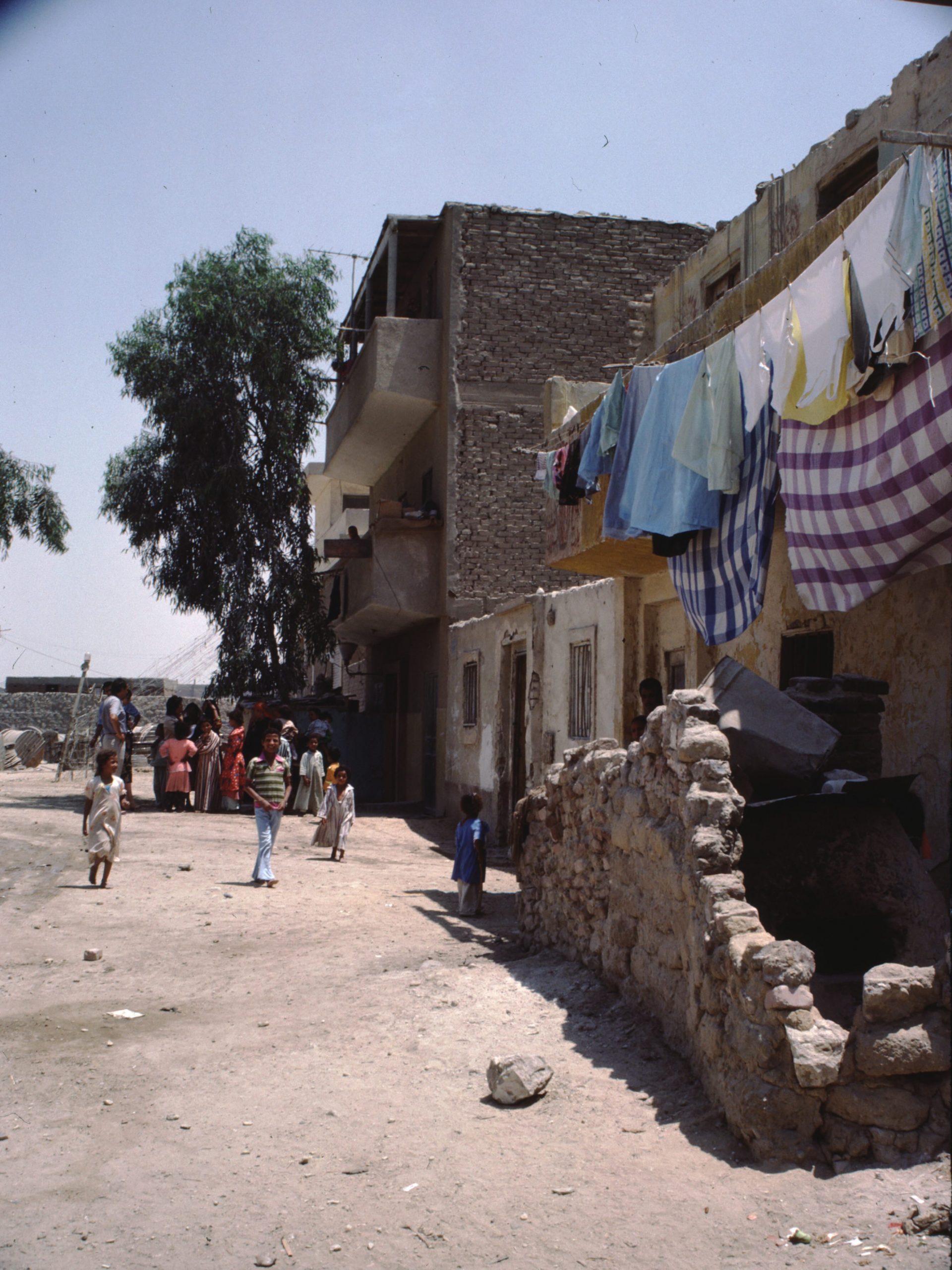
GALLERY M01-6: Public Housing Selection: Helwan Public Housing and Imbaba Squatter Settlements, Helwan (1982-1985)
97 images
Digitized slides depicting photographs of public housing neighborhoods in Helwan, and Imbaba squatter settlements. outside Cairo, Egypt from 1982, 1984, and 1985.
External views show urban fringe housing conditions, construction, deterioration, and occupants in Helwan, comparing high-rise new housing (1982) to Imababa squatter neighborhoods (1985). Shows “housing development enlargement” project in Helwan Public housing, from 1984. Streetscapes of residents in Imababa squatter settlement region include views of squatters, and children playing in streets.
Additional subjects include: animals, laundry, exteriors of public housing, deteriorated wall detail, gutters, sewage and standing water, balconies and building support structure detail.
Gallery M01-6. MSDA: Mona Serageldin Digital Archive. Institute for International Urban Development. I2UD Digital Library. Digitized June 2021.


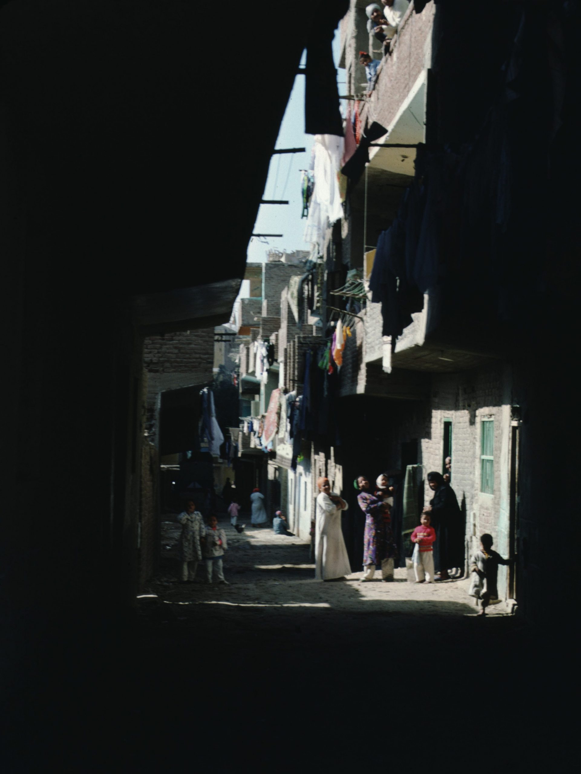
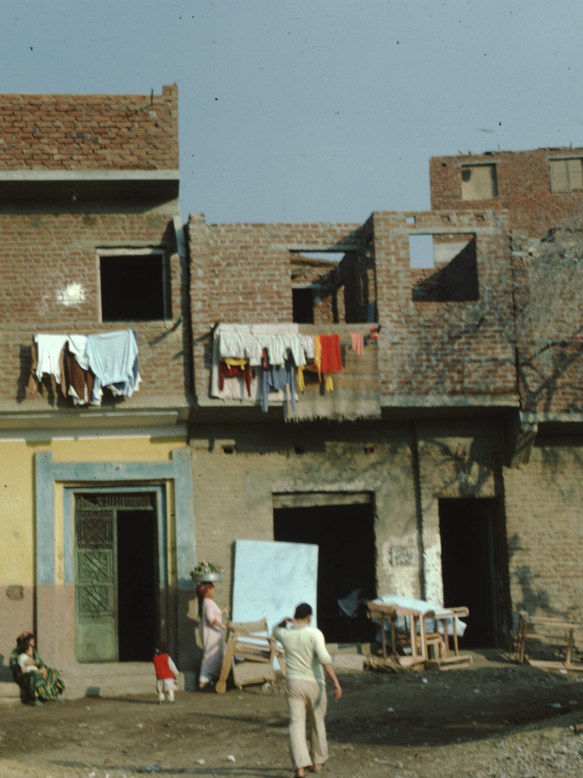
GALLERY M01-7: Ghoneim Main Settlement and Ghoneim North Coop, Helwan (September 1985)
143 images
Digitized slides depicting photographs of Ghoneim Main, and Ghoneim North Coop housing settlements in Helwan, in the urban fringe outside Cairo, Egypt, from September 1985.
Photographs depict housing conditions and streetscapes, comparing new and old building styles in Ghomeim Main and Ghomeim North settlements, including squatter quarters. People pictured are primarily women and children, many the families of migrant workers. Portraits of individuals and families make up a backdrop of women and children in doorways, side streets and at water sources.
Images of sewage, gutters, community waterways, old and new roof conditions and housing deterioration. Detail of school upgrading project and sewer upgrading projects (1985).
Images include detail of community waterways and water access, old and new roof conditions and housing deterioration, and detail of a school upgrading project and sewer upgrading projects (1985). Images include views of squatter shelters, details of dwellings, new communal facilities, ongoing construction sites, existing sewers, gutters and garbage, roof conditions, and livestock.
For detailed subject, date, and geographic metadata, see individual image captions.
See also:
Gallery M01-3: ‘Old and New Informal Settlements, Ghoneim, Helwan’ (1980-1982, 1985)
Gallery M01-7. MSDA: Mona Serageldin Digital Archive. Institute for International Urban Development. I2UD Digital Library. Digitized June 2021.


GALLERY M01-8: Ghoneim North Coop Housing and Informal Settlements in Southern Fringe, Helwan Area (1980-1985)
124 images
Digitized slide photographs of Ghoneim North Coop, and informal settlements in the Southern urban fringe in Helwan, south of Cairo, Egypt from 1980, 1982, 1984, and 1985.
Images of the Ghoneim informal settlements document housing conditions, houses and construction sites, road-side surveys of Helwan showing condition of streets and communal buildings, waterways and sewers. Community pictured includes children and adult residents, engaged in laundry and care of livestock.
Original sections and dates:
- “Road to Helwan” (April 1982)
- “Helwan N/C” (September 1985)
- “N/C Site 1982 Pot Coop Hsg” (1982)
- “Helwan selection” (May 1980)
- “Helwan, Ghoneim, Maushrel Nasser Citadel” (1982)
- “Ghoneim” (April 1982)
- “Rached” (1982-1985)
- “Ibbet el walda Helwa” (September 1984)
- “Helwan El Balad” (1984)
See also:
Gallery M01-3: ‘Old and New Informal Settlements, Ghoneim, Helwan’ (1980-1982, 1985)
Gallery M01-8. MSDA: Mona Serageldin Digital Archive. Institute for International Urban Development. I2UD Digital Library. Digitized June 2021.


GALLERY M01-9: Informal Settlements in Abu Dahroug, El Hekr, and Imbaba Moumira, Cairo (July 1981 and September 1984)
124 images
Digitized slide photographs of neighborhoods in the informal settlements of Abu Dahroug, El Hekr, and Imbaba Moumira, and Boulaq Dakrour slum outside Cairo. Images date from September 1984, with outlying selections from July 1981.
Images depict neighborhoods, housing, and street scenes in the urban fringe region of Helwan, Cairo, including waterfronts, high rise buildings, old deteriorated buildings and new housing construction, residents, streets and traffic, alleys, agricultural crops (corn), roof conditions, trash and gutters, people and goats, and slum housing conditions.
“Abu Dahroug” – September 1984: Photographs of Abu Dahroug housing, children and residents, houses and construction sites.
“El Hekr” – September 1984: Photographs of El Hekr settlement area, with views of housing buildings, streets, and resident children and families. Two sections of slides: First of residents and families alongside inner residence streets; Second of construction zones, roads, bridge infrastructure, water pump scenes, and landscape views of region.
“Imbaba Moumira”; “Imbaba selection of Jul. 81” – September 1984, July 1981: Photographs of Imbaba Moumira slum in the “Mounira section of Imbaba, located in middle of Cairo’s poorest district.”
“Imaba Banaji Boulaq El Dakrour” – September 1984: Photographs of Boulaq Dakrour slum, with views of infrastructure, housing, streets, alleys, agricultural fields, street crowds. Original Note: “El Hekr (Hair El Salam) project was one of three selected and included uncontrolled low income housing on the northern perimeter of the city, and adjacent empty desert land.”
Citation: “Urban Projects Manual: A Guide to the Preparation of Projects for New Development and Upgrading Relevant to Low Income Groups, Based on the Approach Used for the Ismailia Demonstration Projects,” Egypt (2000).
Gallery M01-9. MSDA: Mona Serageldin Digital Archive. Institute for International Urban Development. I2UD Digital Library. Digitized June 2021.


GALLERY M01-10: Scenes in Saft El Laban and El Warraq, Giza (1984-1985)
164 images
Digitized slide photographs of informal settlements in Saft El Laban from September and November 1985, and in El Warraq, Giza governorate from December 1984.
Images from Saft El Laban include street scenes, residents, and children, types of housing, agricultural projects, livestock, waterways and pollution, skylines, and abandoned structures (September 1985).
Images from El Warraq, including street scenes, construction sites, rivers and waterways with trash, and skyline and landscape views of buildings (December 1984).
Additional selections with titles in Arabic, depicting street scenes, construction sites and vehicles, rivers and waterways with trash, skyline and landscape views of buildings, residents and children, fruit market (watermelons), women in streets, slum gutters, and trash fires (September 1985).
See also: I2UD Digital Library Study Guides, Informal Settlements Album
Gallery M01-10. MSDA: Mona Serageldin Digital Archive. Institute for International Urban Development. I2UD Digital Library. Digitized June 2021.


Next Page: Medieval Cairo (M02)